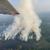
Astray Fire (Timo Rova/UDSA Forest Service)
This week, four new wildfires were spotted in and near to the Boundary Waters Canoe Area Wilderness. Efforts are underway to contain the blazes, while the Forest Service has now closed entry points, lakes, and campsites in response. Firefighters are working to suppress and contain the fires.
There are also multiple fires burning across the international border in Quetico Provincial Park, including a pair of fires totalling about 175 acres near Burt Lake. All Canadian fires are currently being monitored and fire restrictions have been put in place across northwest Ontario.
The entire region is currently in moderate drought, with the dry conditions contributing to the fire risk. Storms producing lightning have moved through the area in recent days, which is believed to have ignited all current fires.
Four fire fights
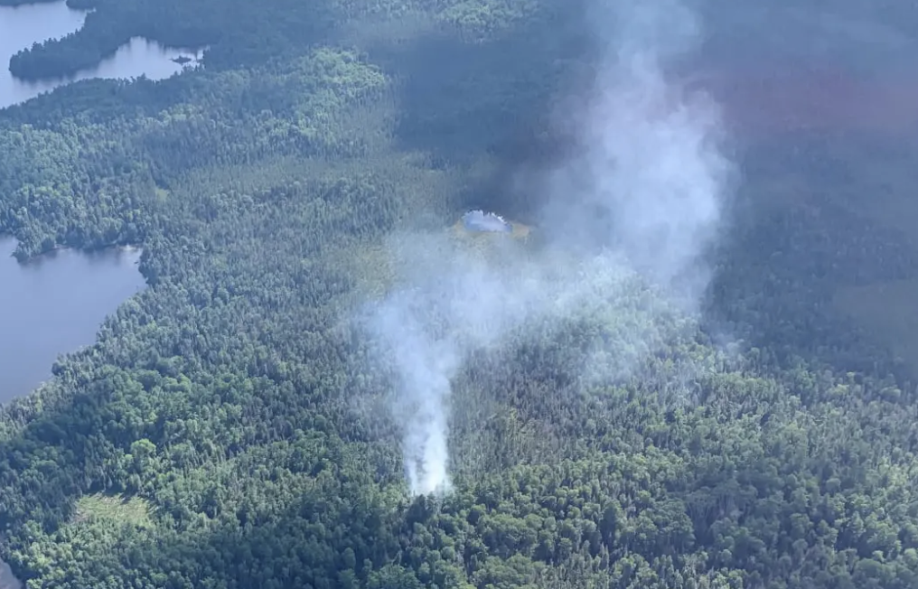
As of Saturday, July 10, the four fires on the Superior National Forest, all within 20 miles of Ely, are being managed together as the West Zone Superior Fires:
- Delta Fire: approximately 62 acres, south of Snowbank Lake, approximately 19 miles east of Ely; burning in an area of heavy blowdown with Spruce budworm-killed balsam fir.
- Astray Fire: approximately one acre, east of Clearwater Lake in the BWCAW, 11 miles east of Ely, burning in mixed timber forest and blowdown.
- Picketts Lake Fire: approximately one-tenth acre, burning in balsam fir forest and blowdown south of Picketts Lake, four miles northeast of Ely.
- Hassel Fire: approximately 10 acres in the BWCAW west of Crab and Burntside Lakes, 10 miles northeast of Tower.
The Delta Fire, the largest of the group, is burning in “heavy blowdown” from a 2016 storm. It is located on National Forest land just outside the Boundary Waters at the end of the Fernberg Road. On Friday, a special team of incident managers took over leadership of the Delta Lake effort.
At that time, there were 13 firefighters, three fire engines, and various aircraft working on the Delta Lake Fire. Firefighters on the ground were using chainsaws to cut a firebreak along the southern edge of the fire, as well as putting out spot fires ignited by embers outside the main zone. They had to first cut access, escape routes, and helipads in the blowdown before they could safely engage the fire.
Additional firefighters, engines, aircraft and other resources were being requested from around the country, but the Forest Service reports national personnel and equipment shortages are making it difficult to secure reinforcements.
Precautionary closure
On Friday, the Forest Service took two steps to keep visitors safe and prevent more fires. The agency announced a Forest-wide campfire ban, except in approved structures in some campgrounds, and closed a swath of the wilderness east of the Delta Fire to all visitors.

The closed area is not actively burning, but is in the area where firefighters believe the fire could expand if conditions allow and the blaze runs with the wind. The closure essentially includes the entire Kekekabic Hiking Trail. The extensive closure is also a precaution because of the limited resources available to suppress the fire.
Currently, the following areas are closed:
- Drag Primitive Management Area
Entry points:
- #56: Kekekabic Trail East
- #74: Kekekabic Trail West/Snowbank
Lakes:
- Parent
- Disappointment
- Jitterbug
- Ahsub
- Becoosin
- Benezie
- Adventure
- Rifle
- Bridge
- Fire
Campfires are prohibited across the Superior National Forest except in designated structures at the following campgrounds: Birch Lake, Fall Lake, Fenske Lake, South Kawishiwi River, Whiteface Reservoir, Cadotte Lake, Sawbill, Crescent Lake, Temperance River, East Bearskin, Flour Lake, Iron Lake, Trails End, Devils Track, and Two Island Campgrounds.
Hot, dry season
This year has already been active for wildfires in northern Minnesota — mirroring the early, intense fire season in the western U.S. In May, the Bezhik Fire began in the western Boundary Waters. Ultimately burning almost 800 acres, it also destroyed four private structures outside the wilderness.
The Boundary Waters region has a slight chance of light precipitation over the next week, but nothing significant. Fire conditions are expected to remain risky.
Fire has long been a part of the Boundary Waters ecosystem and is important for healthy forests and the primordial scenery sought by visitors. Regular fire can prevent the build-up of dead wood that fuels ferocious fires. Iconic tree species like jackpine require fire to reproduce.
In addition to lightning-caused fires, recent research has revealed that humans have been intentionally setting fires in parts of what is now the Boundary Waters for centuries, if not longer. The Forest Service and other land managers continue to conduct prescribed burns on the Superior National Forest, but rarely in the Boundary Waters.
While the major fires currently burning were all believed to be started by lightning, across the country, nine out of 10 wildfires are ignited by people. That includes very destructive wildfires in the Boundary Waters, such as the Ham Lake Fire of 2007.
More information:
- West Zone Superior Fires – InciWeb
- BWCAW / Superior National Forest Fire Restrictions
- Superior National Forest Fire and Aviation Information
- Forest Fires Information, Ontario Ministry of Natural Resources and Forestry
- 10 Tips to Prevent Wildfires – U.S. Department of Interior
Republished with permission via queticosuperior.org