Navigation
Showing 25–36 of 87 results

Download or MicroSD Card
We've mapped every hill and valley for your next great adventure. Now with more detail than ever, this product covers the finer points of the outdoors with topographic maps comparable to 1:100,000 scale USGS maps. It also includes terrain contours, topo elevations, summits, parks, coastlines, rivers, lakes and geographical points.
We've mapped every hill and valley for your next great adventure. Now with more detail than ever, this product covers the finer points of the outdoors with topographic maps comparable to 1:100,000 scale USGS maps. It also includes terrain contours, topo elevations, summits, parks, coastlines, rivers, lakes and geographical points.
$99.99

A complete set of the 15 maps covering the Superior-Quetico canoe country from Grand Portage to International Falls. All of the land in the Boundary Waters Canoe Area, Voyageurs National Park and Quetico Provincial Park is included. Forest boundaries, motor routes, portages and campsites are detailed. The book is an excellent reference to the canoe country and is helpful in trip planning. A historical map is also included.
$17.95

Rely on DeLorme Atlas & Gazetteer paper maps for the utmost in trip planning and backcountry access. It's available in paperback (11-inches x 15.5-inches) for all 50 states.
$19.95

Finding your way around in an unfamiliar area of Canada can prove challenging without a topographic map. There are 1:250,000 scales maps to help you find your destination, while the 1:50,000 scale maps are available to let you zero in on a particular site. They show lakes, rivers, streams, marshes and the elevation of surrounding land.
$19.95

Software
Fugawi Global Navigator is the ideal PC software tool for route planning and real-time GPS navigation using a wide variety of raster charts.
Fugawi Global Navigator is the ideal PC software tool for route planning and real-time GPS navigation using a wide variety of raster charts.
$129.00

Waterproof. Some of the key areas of interest featured on this map include Eagle Mountain, Lake Isabella State Forest, Chik-Wauk Museum Nature Center, Kekekabic and Border Route trails, and Gunflint Trail National Scenic Byway. Features found on this map include: Boundary Waters Canoe Area Wilderness, Eagle Mountain, Kelso Mountain, Misquah Hills, Saganaga Lake, Superior National Forest.
$17.00

Waterproof. Created in partnership with local land management agencies, this expertly researched map features key areas of interest including the International Wolf Center; Echo Trail roadway; Burntside, Vermilion, Trout, and Snowbank lakes; Little Indian Sioux and South Kawishiwi rivers; Kekekabic Trail; and Taconite State Trail.
Features found on this map include: Basswood Lake, Boundary Waters Canoe Area Wilderness, Crooked Lake, Lac la Croix, Superior National Forest, Trout Lake, Vermilion Lake.
$17.00

Waterproof. Contains detailed park information including hiking trails, campgrounds, portages, trails, trail access points, roads, park services, and more. Featured in this map: Gull Island Rookery, Grassy Bay Cliffs, Anderson Bay, Kettle Falls, Hoist Bay, Gold Portage, Ash River, Crane Lake, Kabetogama and Rainy Lake Visitor Centers.
$17.00

Waterproof. This Trails Illustrated topographic map for Apostle Islands National Lakeshore, and surrounding area in northern Wisconsin includes Devils Island, North Twin Island, South Twin Island, Rocky Island, Bear Island, Otter Island, Ironwood Island, Cat Island, Outer Island, Manitou Island, Oak Island, Stockton Island, Michigan Island, Hermit Island, Basswood Island, York Island, Sand Island, Eagle Island, Sand Point, Point Detour, Madeline Island, Big Bay State Park, Long Island, Chequamegon Point, Lake Superior, an island-to-island mileage chart, the city of Bayfield, Little Sand Bay, and much more. Includes UTM grids for use with your GPS unit.
$17.00
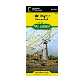
Waterproof. National Geographic’s Trails Illustrated map of Isle Royale National Park delivers unmatched detail and valuable information to assist you in your exploration of this remote wilderness. Created in partnership with local land management agencies, this expertly researched map features key areas of interest including Passage Island, Rock Harbor, Windigo, and many shipwreck sites. Whether day hiking or backpacking to remote campsites, the map’s clearly marked trails with mileage between intersections will help you choose the route that’s right for you.
$17.00