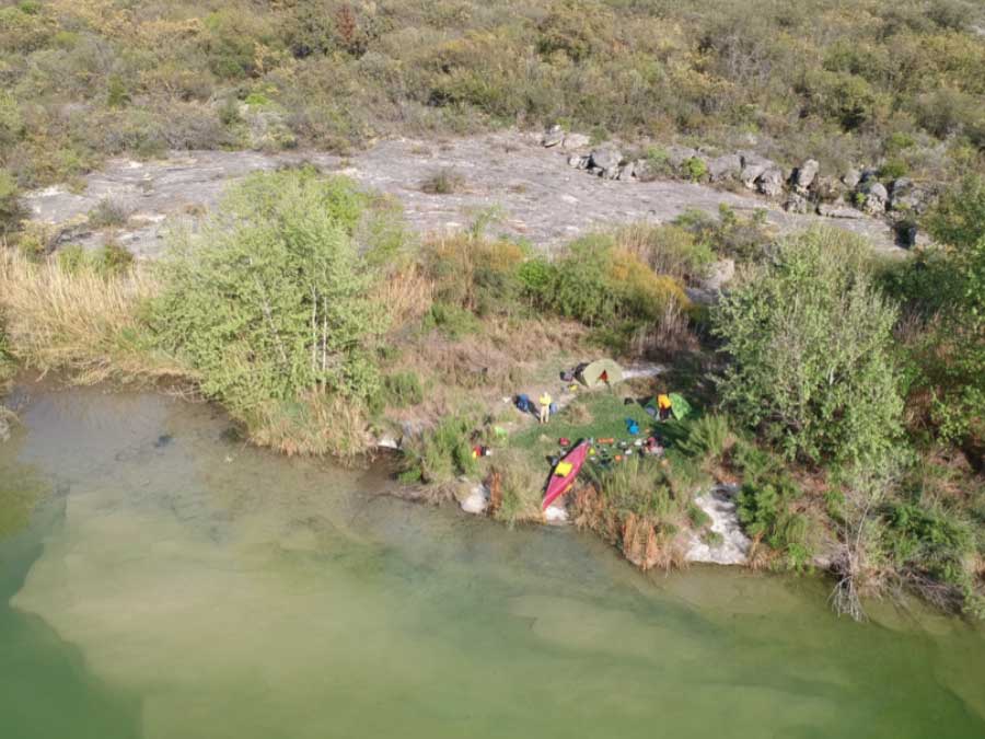
The Mile 29 campsite was a remote location along the shore line of Devils River State Natural Area (Dan A Hughes Unit) All photos courtesy Vern Fish
Devils River
Texas State Natural Area
Trip Report
March 19 – 24, 2020
The Devils River
Short on length and hard to access this little river packs a pretty good punch. The State of Texas lists six Significant Hazards which include one bridge crossing, three CIII rapids, one waterfall (Dolen Falls) and strong winds on Lake Amistad. There are 19 named CI to CIII rapids and dozens of unnamed drops, rock gardens, cane alleys and “jeep crossings” to bedevil a paddler along the way. The reward is crystal clear, clean water, dark skies, spectacular desert scenery, challenging whitewater and a wilderness paddling experience in the middle of an Iowa winter. The Devils River is not for the faint of heart. Less than a thousand paddlers run this river each year.
Located in Southwest Texas, the Devils River is a long ways from anywhere. It is 450 miles east of El Paso and 220 miles west of San Antonio. It is over 1,200 miles from Waterloo, Iowa. The river is short. There is only public access to the lower 47 miles. Of that distance, the last 16 miles is partially covered by the waters of Lake Amistad National Recreation Area. From Bakers Crossing to Rough Canyon Marina, on Lake Amistad, there are only four recognized public campsites. These campsites must be reserved in advance. Most of the shoreline is privately owned and closely protected.
I found our 47 mile trip down the Devils River was tough to plan and physically challenging to complete. The logistics can be daunting. Everyone must have a Devil’s River Access Permit (DRAPs) to access the river on a certain date. Camping is only allowed at one of the designated campsites. These sites must be reserve in advance for a specific date. One can camp on the limited number of islands in the river, if they are not flooded. The distance between designated campsites is eight to twelve miles. As noted, the distance between campsites is filled with a variety of impediments which can include high or low water.
One must keep one eye on the map and the other on the sky. This river is noted for its extremes. Scant rain in its desert watershed leaves this river dependent on spring water. The lack of rain can turn a paddle into a hike. A rare heavy rainstorm can swell this little river into a raging torrent overnight. Our shuttle driver, Emilio, left us with one piece of sage advice, “Always have an escape plan.”
Yet the Devils River was a gem to see and I will treasure the experience. They say there are two kinds of paddlers on the Devils River: those that come back whenever they can and those who will never do it again. I would do it again.
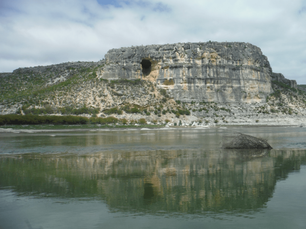
Curly Tail Panther Shelter is located on this bluff face Lake Amistad at Mile 38.5. The most prominent pictograph is a large, red panther with a long curling tail.
Trip Outline
Trip Dates: March 19-24, 2020
Nearest Cities: Comstock, Texas, Del Rio, Texas
Put in: Baker’s Crossing, Texas Highway 163
Take out: Rough Canyon Marina, Lake Amistad National Recreation Area
Distance: 47.7 miles
Water level: 83 CFS – Bakers Crossing USGS, 250 – 300 CFS – Pafford Crossing USGS
Boat: Spirit II, Wenonah (Roylex)
Shuttle Driver: Emilio Hinojosa, Emilio’s Charter Service
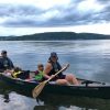
Paddlers: Will Witt, Beaver Crossing, Nebraska; Vern Fish, Waterloo, Iowa
Difficulty: Intermediate – The Devils River provides a variety of whitewater challenges ranging from CI-CIII. Paddlers must have wilderness camping experience and be prepared for a physical challenge.
Submitted by: Vern Fish, vernfish@aol.com
Trip Planning
The first step is to read the trip guide written by Louis Aulbach, The Devils River (ISBN 978-1468022759). This well written guide provides a detailed outline for planning a trip. In today’s digital age one should be able to find a copy online. This guide can be directly ordered from Louis Aulbach.
Louis Aulbach, P.O. Box 925765, Houston, TX 77292-5765
Please note that Mr. Aulbach’s guide is dated. It does not show the campgrounds the State of Texas acquired to provide better access to the river at mile 12, 20 and 29. The Dan A. Hughes Unit of the Devils River State Natural Area is not included in the guide. With that said, I would still encourage you to read and use the book.
Texas Parks & Wildlife has created an outstanding planning guide on their website at https://tpwd.texas.gov/state-parks/devils-river/river-trips. This site includes a great video and the information needed to get Devil’s River Access Permit (DRAPs) and reserve campsites. This website does an excellent job of identifying the hazards and impediments for which one must be prepared to address. The website includes a lot of details that will take time to absorb. I have tried to list the important river features a paddler will encounter in the attached Table of Features.
The Devils River Conservancy is a valuable source of information. This website can be accessed at https://www.devilsriverconservancy.org/. The Southwest Paddler also provides a nice summary of the route at http://www.southwestpaddler.com/docs/riogrande9.html.
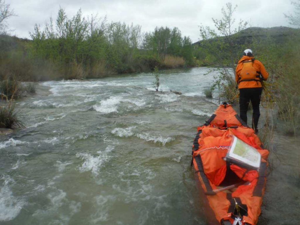
Will Witt lining down Indian Rapid at Mile 20.
Trip Reports
There are many trip reports and YouTube videos on paddling this river. The following article is a good starting point https://texashighways.com/travel/outdoors/paddling-the-devils-river-in-southwest-texas/
Water Levels
It is critical to know how much water is flowing in the Devils River. The Bakers Crossing gauging station can be accessed at: https://water.weather.gov/ahps2/hydrograph.php?wfo=ewx&gage=bkct2. We started at Baker Crossing with the river was running at 83 cfs. At this level, we were just able to squeeze under the old Bakers Crossing Bridge, just downstream. If the water had been higher, we would have been forced to portage around this bridge and our first campsite at Miller’s Island at mile 7.33 might have been under water. As it was, we spent a lot of time dragging and lining the canoe over shallow runs.
The gauge at Paffords Crossing is near the end of the trip. This gauge can be accessed at https://water.weather.gov/ahps2/hydrograph.php?wfo=ewx&gage=cmkt2. If the water level is below 250 cfs, there might not have enough water for the last half your trip. For our trip, the water level ran from 250 to 300 which seemed like a lot of water. We had trouble portaging around Dolen Falls due to the high water level.
Finally, it is important to know the water level in Lake Amistad. This gauge can be accessed at https://water.weather.gov/ahps2/hydrograph.php?wfo=ewx&gage=amit2. The lake was at 1077 ft. which is 40 ft. below its approved level. This meant that the stretch below Pafford Crossing was not flooded and created a long series of shallow rapids that had to be walked or lined until mile 39.
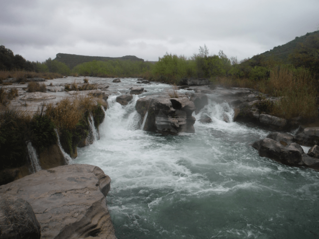
Dolen Falls is located on mile 16. This is the largest, continuously flowing waterfall in Texas.
Devils River Archeology
There are hundreds if not thousands archeological sites within the Devils River Valley. Most of these are on private land or are a considerable distance away from the river. We did not leave the river to find or explore any of these sites. Louis Aulbach’s book provides a nice summary of sites located in the river valley.
Shuttle Driver
Finding a shuttle driver is important. We used Emilio Hinojosa who lives just west of Comstock, Texas. He shuttled us out to the Bakers Crossing for $200 and left our vehicle at the Rough Canyon Marina on Lake Amistad on the day of our return. There are several other outfitters who provide this service. They are listed on the state website. Only state registered outfitters can leave vehicles at access points within the two units of the Devils River State Natural Area. Do not leave a vehicle at Bakers Crossing!
Emilio Hinojosa, Emilio’s Charter Service, P.O. Box 733, Comstock, Texas 78837 830-317-0760 (c)
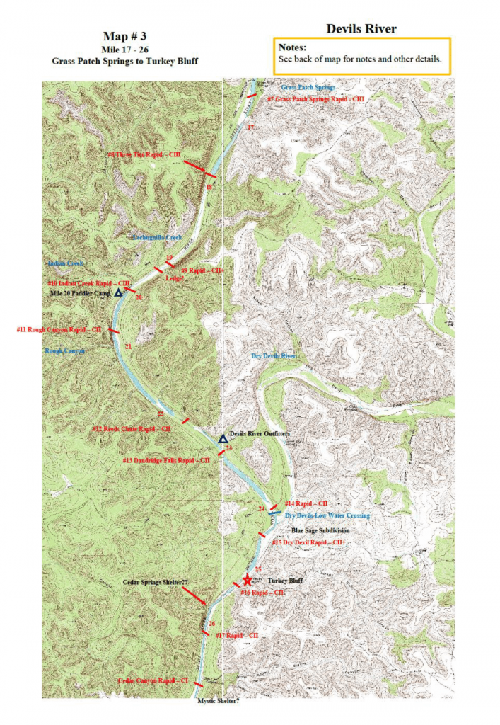
Maps
I ordered a CD of 1:24,000 digital maps from YellowMaps (www.yellowmaps.com). This CD was titled Southern Texas, Volume 24, Zone 14-5. Zone 14-5 covers the Devils River. I then digitally knitted the following quadrangle maps together to create five, 13 x 19 maps:
Bakers Crossing (029101H2) Clarks Waterhole (029100G8) Dolen Springs (029100H8)
Gills Ranch (029101F1) Lechuguillia Creek (029101G1) Rough Canyon (029100E8)
Statan Canyon (029100F8) Telephone Canyon (029101H1)
These maps were laminated to fit into a standard Sea to Summit map case. A sample of these maps has been attached to this report.
Permits & Fees
Devil’s River Access Permit (DRAPs) cost $10 per paddler. These permits can be obtained up to five months in advance by calling the Texas State Parks Customer Service Center at 512-389-890. Ask for the Devils River agent. Campsites can be reserved at Mile 12, San Pedro Paddlers Camp, Mile 20 or Mile 29 by calling Customer Service Center. These reservations cost $5 per night per paddler.
Emergency Contact Information
The following numbers were programed into our satellite phone:
Val Verde County Sheriff’s Office 830-774-7513
Border Patrol (Comstock) 432-292-4600
Amistad National Recreation Area 830-317-0760 (c)
General Park Information 512-389-8901
Emilio Hinojosa 830-775-7491
Dennis Molln was our designated “Guardian Angel”. He got all of our satellite phone messages and he tracked our progress. He provided weather reports and water level updates. If we had gotten in trouble, he would have been our link between the authorities and our families.
Food & Motels
There is one motel in Comstock, the Comstrock Motel (432-292-4484). The only gas station convenience store is located across the street from Comstock Motel. The only restaurant, JP’s (432-292-4338), is located down the street from the Comstock Motel. Del Rio, Texas is closer to the Rough Canyon Marina and features a wide variety of motels and restaurants.
A typical cane choked “drop” on the upper segment of the Devils River.
Highlights & Observations
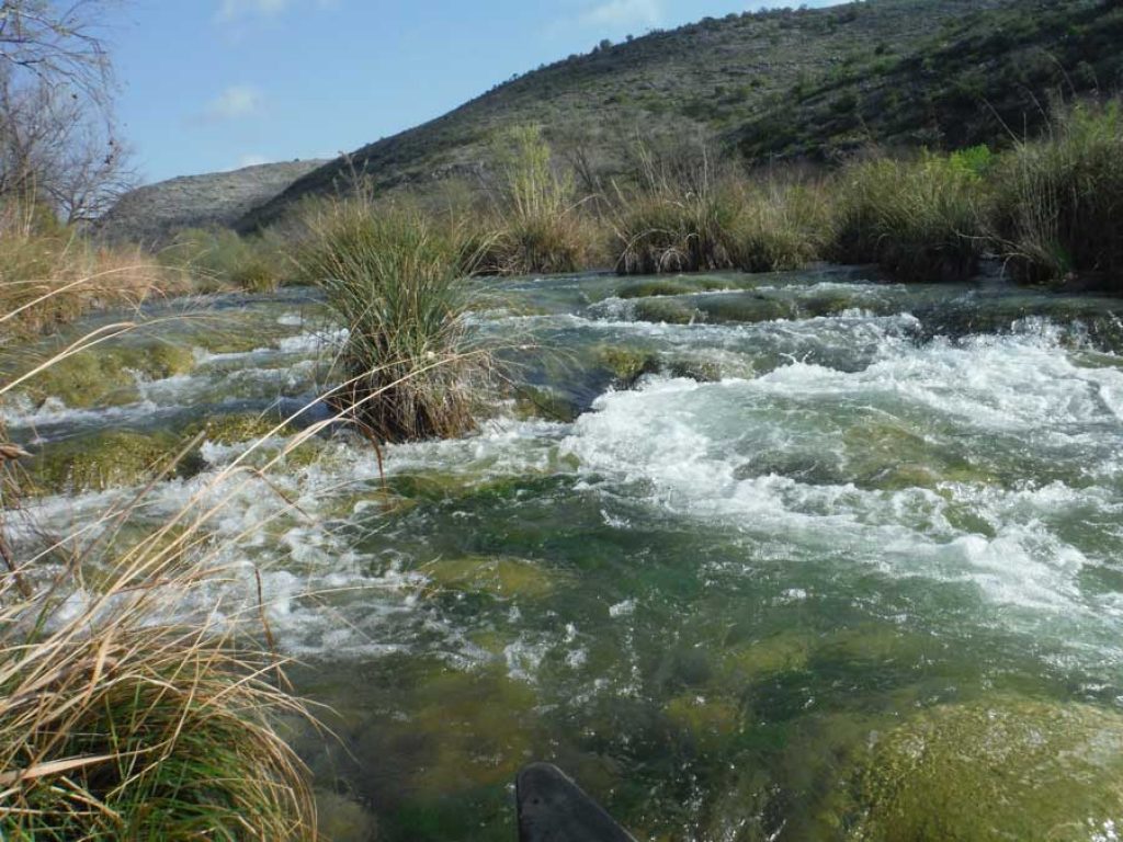
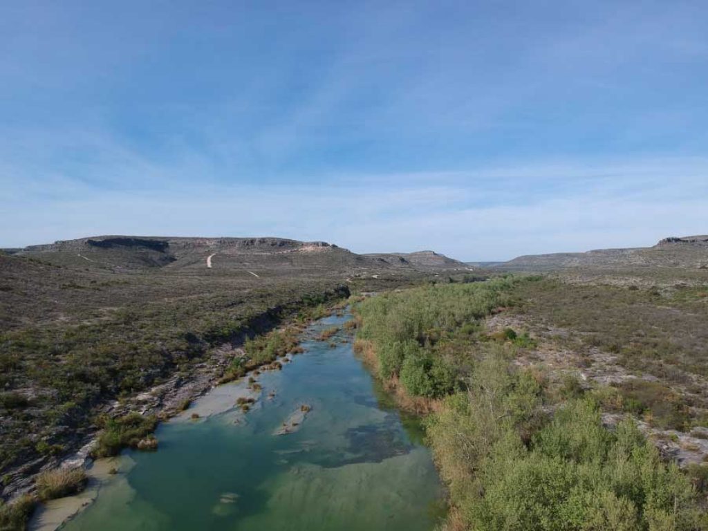
The Devils River is a small river that demands respect and attention. It is a forty-seven mile obstacle course that is constantly trying to reach up and grab the boat and pin it against a rock. The upper third flows through a floodplain filled with sycamore trees, big bass, weekend homes, cane alleys, shallow rapids and signs warning of the consequences of trespass. The middle third of the river starts to sinks into a canyon surrounded by desert and cliffs. The clear running water now pulls the paddler into bigger rapids, drops and ledges. The last third is the flat water of Lake Amistad. The water is muddy but the cliffs are very impressive.
Once the descent of the upper third has been completed there are fewer people to be seen. There are roads and some buildings but there are very few people waving at you. The campsites are remote and provide solitude in big, open landscape. Water level is critical. Too much water, a CII becomes a CIII rapid. Too little water, the trip becomes a hike with a canoe. The water level on Lake Amistad impacts the last 6 miles of the river. We spent most of our fifth day walking the canoe down exposed limestone ledges that should have been under several feet of lake water.
In hindsight, solo canoes or kayaks would have worked better than a 17 foot expedition canoe. Smaller boats would have been much easier to paddle through the tight turns and shallow rapids. I also would have spent an extra day and camped at San Pedro Point Paddler Camp at Mile 14. This would have shortened the distance to Mile 20 Campsite and given us time to explore the Devils River State Natural Area (Del Norte Unit).
Looking upstream at Rapid #18 at Mile 29. The right shore line is part of the 18,000 acre Devils River State Natural Area (Dan A Hughes Unit).
The Value of Wild Rivers
The Devils River is a wild river that runs through a spectacular landscape. It was a good place to hide. As we drove south, from the last grip of winter in the upper Midwest, we were constantly reminded of the oncoming impact of a possible world pandemic. However, for six days we were forced to focus on running whitewater and weaving though cane islands. The last thing we were worried about was a strange new virus.
When we emerged from our voluntary retreat, we were sunburned and bruised but refreshed. However, in the course of 6 days the world had changed. The bars were closed and people were wearing masks. Everything seemed upside down. We had gone from the high of running CII whitewater on crystal clear water to watching people die in record numbers on CNN.
The trip home was surreal. Main streets in small towns were empty. The schools were shuttered and the only food available was carryout from Sonic restaurants. When I got home, I was told I had to self-quarantine for 14 days because I had been to Texas. I have always cherished the value of a wild river. As I emerge from my self-isolation, I have the memory of wild river in southwest Texas to off-set the scary new world I must rejoin. I can only hope that there will always be wild rivers where people can go to renew and rejoice.
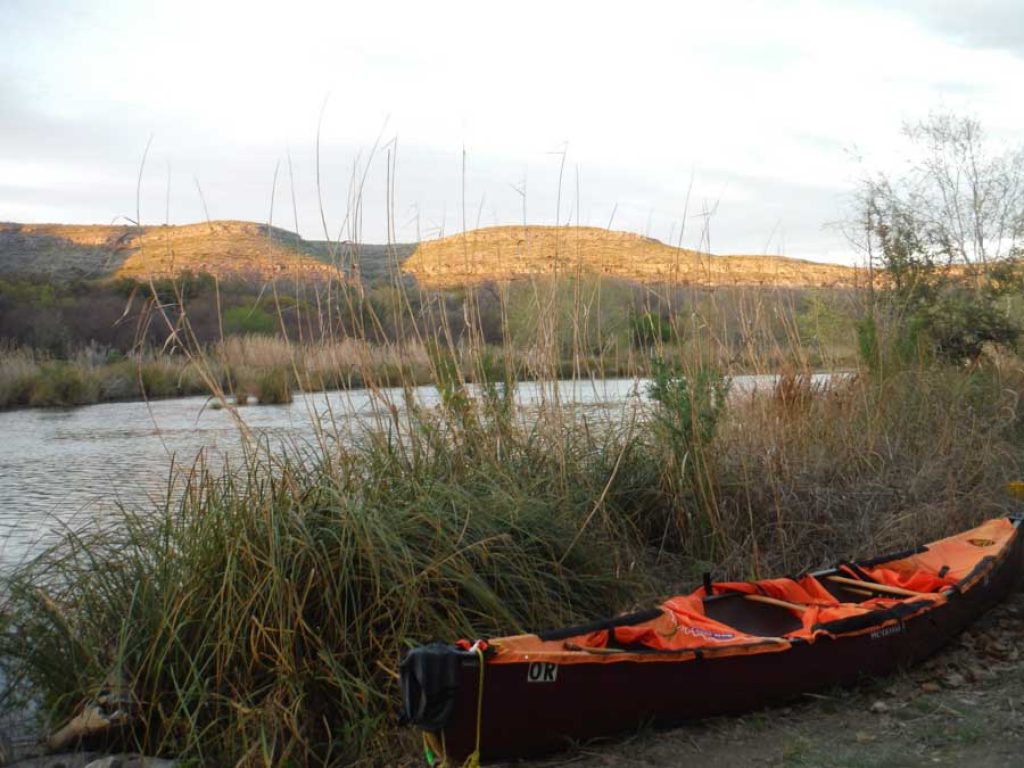
The view from Mile 12 Campsite as the sun sets.
Submitted by: Vern Fish, 3488 Kingswood Place, Waterloo, Iowa vernfish@aol.com. See the attached Photo File for trip images and the Table of Features for summary of trips. The five maps that were created for this trip have also been attached. A trip log, which is a separate document, provides a daily summary and more trip details.
Download the Trip Report with Maps [PDF]
Devils River Trip Photos [PDF]