Canoe the Heart Leg C: Celebrating the Quetico Provincial Park and Superior National Forest Centennial
TRIP LOG: Submitted by Tim Eaton, July 14, 2009
This leg of Canoe the Heart paddled from Crane Lake at the southern end of Voyageurs National Park to Fall Lake in Ely, Minnesota. The four day trip covered a distance of ninety-eight miles, included nine portages totaling 737 rods (3,713 meters) and required lining the canoe up three sets of rapids. Our route included two bonus portages and two beaver dam pullovers to detour the Beatty mechanical portage between Loon and Lac la Croix.
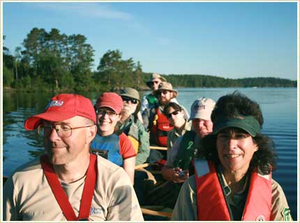
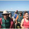
Leg C Crew (left to right, front to back): Robin Reilly and Nancy Hernesmaa, Kate Logan and Cathy Quinn, John Craig and Ann Schwaller, Jason Johnson, Will Hauser. Not pictured Tim Eaton. Photos courtesy Tim Eaton unless otherwise noted.
The Route
Day one—July 6th
Distance: 28 paddling miles Time: 10.5 hours
King William Narrows on Crane Lake to Lac la Croix on the International border, with three portages and two beaver dams to drag over.
Details:
Start point was a campsite on a point of land just north of Indian Island at the south end of King Williams Narrows on Crane Lake. Paddled north three miles, turned east and then south into Little Vermillion Lake, paddling against the flow of the water. Passed Hangman’s Island and Little Vermillion Narrows and paddled into the Loon River. Turned east, then zig zaged south and east through another narrows ending at Loon Falls. There is a mechanical portage around Loon Falls into Loon Lake and another at the north arm of Loon into Lac la Croix. Today’s destination was Snow Bay on Lac la Croix.
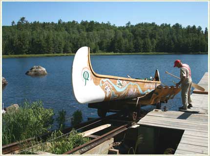 Robin Reilly at the Loon Falls mechanical portage.
Highlights:
The motorized boat traffic was relentless, the still quiet morning was intruded by the sound of motors echoing from one side of the densely tree-lined waterway to the other. The odiferous smell of gasoline permeated the nostrils. As each boat passed, the still water surface was broken into a set of canoe surfing waves. Motors are allowed on the Canadian side of the border and the fishing is said to be fantastic in Lac la Croix.
Fifteen miles from our start was Loon Falls, the first of two mechanical portages available en route to Lac la Croix. The Loon Falls mechanical portage, operating since 1918, is unique and interesting from a historical perspective but on the day we passed through we encountered a fowl mouthed, impatient, unfriendly operator who acted out the crusty persona of a backwoods character as if to entertain us. He demanded the fifteen dollars portage fee before he would release the canoe from his railroad carriage and reprimanded us again for being too slow in tying down our canoe. I mentally flipped him off as we loaded the voyageur canoe.
We headed east from the falls on Loon Lake, tracking the international border with the hull of our canoe. The left side paddlers were stoking in Canadian water while the right side paddlers in the USA. We laughed at how silly all this seems but occasionally looked for the shiny new border markers (post 911) embedded in glacial rock, accurately defining the international boundaries of each country.
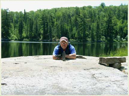
Tim Eaton, pointing North, at international boundary marker on Crooked lake.
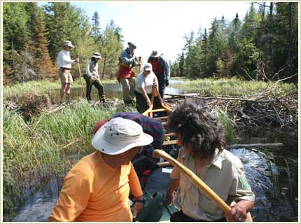
We unintentionally paddled past the north arm of Loon Lake, where the second mechanical portage (Beatty Portage) leads into Lac la Croix. We blissfully found our way into East Loon Bay and north into Little Loon Lake before the water ended and we discovered our navigational error. Consulting our maps, we saw a passageway north into Snow Bay on Lac la Croix, a 147 rod (740 meter) portage taking us from Little Loon into Slim lake. The portage trail was rugged—up and down, narrow, poorly maintained and infrequently traveled. It was the first time Leg C paddlers hoisted the 300 pound canoe over our heads. There were four stations under the canoe from which to carry. Because of the up and down motion the 27’ canoe is seldom carried by all four people. The pain was intense when the weight shifted from one person to the next. We grinned-n-beared the navigation error made earlier and were rewarded to find a nesting loon as we reached Slim Lake.
This narrow, deep lake was lined on both sides with old growth red and white pines, but the best lay just ahead. We dragged the canoe over a beaver dam from Slim into a narrow stream leading to Section Pond, the next lake on the map. As the stream widened into Section Pond, to our right an incredible bog unfolded. There, towering 18’ over the bog were hundreds of Northern Pitcher plants pointing in every-which-direction searching for a hearty meal of insects. It was a haunting site, one that conjured up tales of being eaten alive by these mysterious bog plants. We paddled by with hardly a word whispered.
Beaver Dam pull-over from Slim Lake into Section Pond.
From Section Pond there was a 73 rod (368 meter) portage into South Lake which led to North Lake and another drag over a beaver dam blocking the flow of water from Snow Bay. We reached Lac la Croix, our first day’s destination. Our campsite was on Snow Bay at point of land opposite Percy’s Point.
Day Two—July 7th
Distance: 32 paddling miles Time: 12 hours
Snow Bay on Lac la Croix to Thursday Bay on Crooked Lake, with two portages totaling 219 rods (1,103 meters). Departure time 6:20 am, arrival 6:30 pm with a two hour lunch stop at Rebecca Falls.
Details:
Paddled north from Snow Bay following the lake as it turned in an eastward direction. Island hopped between islands Forty-five and Forty-one, passed the First Nations Lac la Croix community and then dropped southwest of island Twenty-five through the narrows west of Colman Island. Turned east again to Fish Stake Narrows and from there turned south, staying west of Irving Island (pictographs) and Warrior Hill then southeast to the portage around Bottle Rapids into Bottle Lake, Iron Lake and on to Rebecca Falls. Two miles further east is the portage around Curtin Falls into Crooked Lake. Our final destination this day was a campsite seven miles from the Falls between Friday and Thursday Bays.
Highlights:
Highlights today included the Lac la Croix pictographs on Irving Island, Warrior Hill and the story of the bloody ambush that took place there. Curtain Falls and Rebecca Falls, the latter of which splits the mainland into an island of land with a torrid downhill waterway on either side to the Namakan River below. The south shoot, with it’s jagged rock outcroppings and narrow passage, appeared too risky for a canoe while the north side may be passable but only by the most adventurous, skilled whitewater paddlers properly outfitted with Royalex canoes, spray skirts, head gear and a rescue crew on hand.
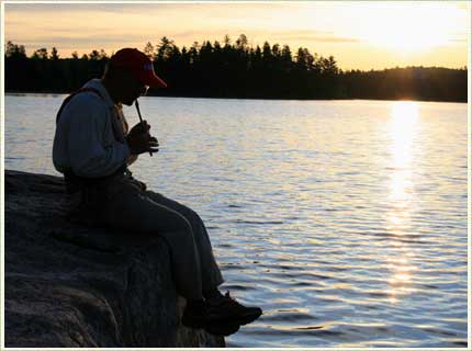
Evening flute recital at Thursday Bay on Crooked Lake
Day Three—July 8th
Distance: 23 paddling miles
Crooked Lake to Pipestone Bay on Basswood Lake. Includes four short portages of 12, 60, 32 and 80 rods totaling 927 meters, and lining the canoe up three rapids to avoid a mile-long portage into Basswood Lake.
Details:
Our route meandered east from Thursday Bay and turned sharply to the north, then east and south into Wednesday Bay, clinging to the eastern shore around a tip of land where the bay openned up. We turned east passing by the ‘table rock’ then turned south. We zigged, than zagged, near the opening to Moose Bay—our course is as crooked as a drunken sailor’s walk. The lake narrowed and the passage closed with sheer rock walls on both sides of the canoe. We passed the Crooked Lake pictographs, an amazing gallery of Anishinaabe ‘rock art’—bright red paintings of people, animals, canoes, creatures and items precious to the aboriginal healers, like pipes, medicine bags, rattles and hand prints of tribal leaders and schmans. We paddled further south to the first of four portages into Basswood Lake. At the second portage, Wheelbarrow, we chose the Canadian route because it was a bit shorter. One more portage and then we were lining the canoe up three sets of rapids, with the last portage a short walk around Basswood Falls. Entering Basswood Lake we headed south past the water level Gauging station marked on our maps and made our way into Pipestone Bay, hoping to find an open campsite at the location of an old resort removed after the Wilderness Act of 1964 was passed into law. The campsite was taken, we paddled on to the next. We were staged just nine miles out from our final destination, making the next day set to be an easy one.
Highlights:
Robin Reilly’s cliff jump, the Crooked Lake pictographs, lining the canoe up the Basswood rapids, the newly improved fire grate at Basswood Falls and the Oberholtzer-Backus area water gauging trolley at the headwater to Basswood Falls.
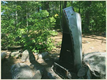
Basswood Falls fire grate.
Day Four—July 9th
Distance: 15 miles
Pipestone Bay on Basswood Lake to the public campgrounds on Fall Lake, with a victory lap around Fall Lake. Two portages, the first around Pipestone Falls and the second around Newton Falls.
Details:
Portage trails were wide and flat, used daily by fisherman with boats and portage wheels headed to Basswood Lake. The voyageur canoe was easily carried over these trails—first into Newton Lake and again into Fall Lake. The campground was almost in site of our final portage but we took a six-mile detour to paddle around the perimeter of Fall Lake, making stops at Nancy and Dan Hernesmaa’s for lunch and at the University of Minnesota’s Research Station donated by the Hubacheck family. In all its splendor, this old lodge was once located near American Point on Basswood Lake.
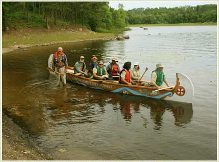
Crew on Fall Lake.
We arrived at the Fall Lake campgrounds at 3:00 pm to a crowd of US Forest Service dignitaries, our replacement crew for Leg D of the Heart and the general public. A few speeches were made at the public beach, a hot meal was served to all, and presentations were given by Jim Saunders of the US Forest Service and Robin Reilly, Park Superintendent of Quetico Provincial Park. We disappeared into the evening and headed home with many good memories of the 98-mile border route from Voyageurs National Park south to Fall Lake in Ely, Minnesota and the crew of Leg C.
Highlights:
Andy Wright, camera in hand, standing in water up to his neck, documenting our arrival at Fall Lake. Andy writes the UpNorthica blog.
 Leg C paddlers at Fall Lake (left to right): Kate Logan, Friends of the Boundary Waters Wilderness; Nancy Hernesmaa, Superior National Forest; Jason Johnson, Quetico Provincial Park; Tim Eaton, Quetico Superior Foundation and Canoeing.com; Kent Connaughton, US Forest Service; John Craig; Robin Reilly, Quectico Provincial Park; Ann Schwaller, Superior National Forest Headquarters; Will Hauser, Northeastern Minnesotans for Wilderness; Cathy Quinn, Superior National Forest. Photo courtesy of Andy Wright- UpNorthica blog.
Maps
We used McKensie series maps; scale 1:31,680 for this leg of the ‘Heart’. Six maps were required:
No 14, Wilkins Bay
No 31, Lac la Croix, Wolseley
No. 13, Lac la Croix
No 29, Argo, Minn. And Williams Lakes
No. 10, Basswood Lake
No. 17, Fall Lake