Yakima River, Washington State From Ellensburg to the Columbia River
TRIP LOG: Submitted by Scott Schuldt, July 26, 2010
Distance/time – 148 river miles, 5 days
Photos by Mike Plahuta and Scott Schuldt
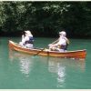
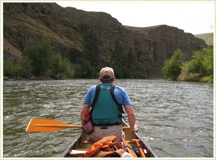
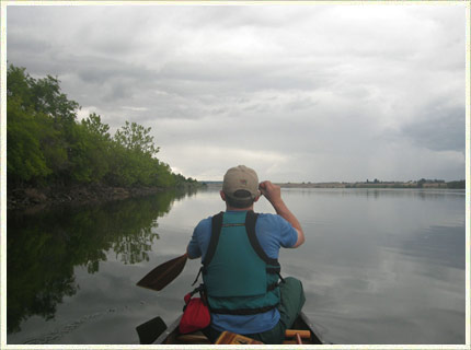
Scott at the stern approaching the Yakima Canyon.
The Yakima River runs east for over 180 miles from the Cascade Range to the Columbia River at Richland, Washington, passing from Cascade foothills to eastern Washington scrub and desert and finally, the Scablands. Since Washington is not a “canoe culture” state, we found little information and no trip reports for the Yakima other than for parts of the first 40 miles.
We started our trip near Ellensburg, WA at the easy to find DNR launch site on Ringer Road, 148 miles from the Columbia River.
The Yakima is major irrigation supply for eastern Washington. There are six diversion dams that must be portaged and flow rates for the various sections of the river can be significantly altered due to irrigation draws. That said, the river turned out to be not at all dominated by agricultural but instead often appeared wild and remote from the canoe with limited road access considering the location. The Yakima would be paddled regularly if it were located in a canoe culture region.
We did locate a river map for the upper section of river from the Bureau of Reclamation (the irrigation folks). There are also several fishing guide services in the Ellensburg area that may be able to provide current river conditions. Below the Roza Dam at mile 128 there was no information on the river other than flow rates and topo maps.
The trip took five full days and our daily distance varied from 12 miles to 44 miles, paddling 8 to 10 hours per day. Sections of the river are easy, most are intermediate, but at least one section is advanced and dangerous even though it contains nothing greater than class II rapids.
There are six dams that must be portaged, Roza, Wapato, Sunnyside, Prosser, Chandler, and Horn Rapids. The report is only valid for the given flow rates, which can fluctuate substantially. Some sections will become very dangerous at higher flows or shallow and toothy with lower flows.
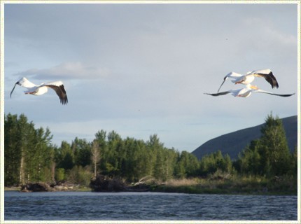
The first of hundreds of white pelicans that we would see. Their wing span is 8 to 9 feet. Sometimes we flushed flocks that numbered 30 to 50 birds.
Flow Rates for sections on the days we were present- May 24 Umtaneum = 2400 cfs
May 24 Below Roza = 1300 cfs
May 25 Parker = 1500 dropping to 1000 cfs
May 27 Prosser = 1500 rising to 2000 cfs
May 28 Kiona = 3000 rising to 4000 cfs
Day 1: May 24 – Ringer Road to Yakima – 37 miles
From Ringer Road to the Roza Dam the route is safe and well known. Soon, the river leaves the foothills and enters the arid and scenic Yakima Canyon. The portage at Roza Dam is on river right just before the warning sign. It is 250 yards and obvious. Below Roza, the river is swift but wide and open with fast riffles that were just barely deep enough for the canoe to float, but no real rapids until exiting the Yakima Canyon near Selah, Washington. Here, some quick maneuvering is required in swift current with an occasional strainer or sweeper in class I water. At the city of Yakima the current and volume increased as the Naches River entered. Some strainers but in a wide river with swift current bank to bank. We camped in the rough out of sight from anyone on one of the dozens of islands.
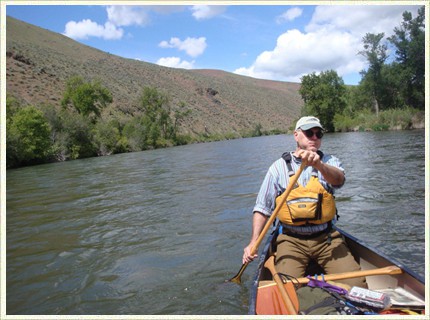
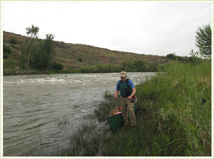
The Yakima Canyon, which is between cities of Ellensburg and Yakima. The white specks are mayflies.
Day 2: May 25 Yakima to river mile 96 – 12 miles
The Wapato Dam is just inside Union Gap just east of Yakima. It is split by an island which we found easy to land on. We portaged easy 200 yards on the river returning to the right channel. Sunnyside Dam comes up next in about 4 miles. It is near Parker, Washington. The dam is unmarked. there is a 1/2 mile long island just above it. We spent 3 hours trying to find a portage. River left is easiest to exit, but there is no legal access back to the river for at least a mile and probably several more due to a major irrigation canal. River right has swift current and landing was difficult. We found the brush impenetrable within 200 yards of the dam until we found an old drainage channel while scouting from the island. Since you cannot see this opening from the water, forget about it. Prepare to portage from at least 1/2 mile upstream on river right. That is what I will do if I do this again. Below the dam, the river becomes braided with hundreds of root balls, strainers and sweepers combined with blind river bends and swift current. We scouted and then lined and waded dozens of these corners and got flipped once when I misread a corner. It took 4 hours to cover 7 miles. There are few road accesses and this section of the river has a very remote wilderness feel and severity even though the sound of I-82 c an be heard in the distance. We had an excellent camp on a gravel bar. We saw hundreds of white pelicans in this stretch of river as well as eagles, hawks, osprey and beaver. It was a very beautiful stretch of water.
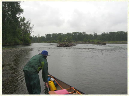
This is in the dangerous 20 mile long section of river between the Sunnyside Dam and Granger, WA. Braided with blind bends, strainers and sweepers,pelicans and osprey, everywhere. We turned Mikes camera into a something more like a canteen in here.
Day 3: May 26 – mile 96 to mile 62
The scouting, lining and wading continued to a few miles past the town of Granger, where we stopped to get drinking water. The water is beginner level after Granger EXCEPT for the first few meanders which require scouting. Irrigation return requires finding potable water, which we found in Granger. Now, the river opens up into an eastern Washington combination of scrubland and farmland. Camping is legal on the state’s Sunnyside Refuge, which is river left from about mile 71 to mile 60. We camped in a nicer farm pasture on river right, out of sight from the farm house. There’s no easy road access out here anyway.
Steinbeck Camp. We opted to camp on the edge of a farmers pasture instead of the hot dry and legal scrubland on the other side of the river. Mike said it reminded him of “Of Mice and Men”…not sure which one of the main characters I was playing.
Day 4: May 27 – mile 62 to Horn Rapids County Park – 44 miles
Easy paddle with only one set of fast riffles to Prosser, Washington. We portaged 3/4 mile through town from the boat ramp to the downriver side of the Prosser Dam. Here the river changes as the rounded cobbles of the upper river give way to the large basalt boulders of the Channeled Scablands. We were lucky to have a few inches of water covering almost all of the rocks. For a dozen miles or so after Prosser, there are sections of class I and class II water, some of which we lined or waded because of blind riverbends in fast current. One of these rapids became a class III at the bottom. The rapids were generally safe but we did quite a bit of back-ferrying. The rest of the day was intermediate paddling with some occasional strong eddies. We camped in the campground at Horn Rapids, which is, unfortunately, a half mile from the river. The campground attendant was most confused by the lack of a motor vehicle at our site.
Walking past one of several rapids. Since we had to walk down and scout around the corners (remember – no river information) we decided we might as well walk with the canoe. This is the Scablands and the river bottom is mostly large basalt boulders. This minor rapid had four nice big class III holes spanning the river just around the bend.
Day 5: Horn Rapids to the Columbia River – 19 miles
Horn Rapids Dam is easily portaged on river left by pulling out above the warning sign and crossing the left irrigation canal on a foot bridge that leads to Native American fishing platforms. At the days flow rates we had nothing more than riffles in fast current to contend with until reaching the Columbia River. With a rare calm day on the Columbia, we turned upriver and paddled 4 more miles right to the bowman’s parents house.
Shuttle – we both live in Seattle, so we left a car in Ellensburg at the Mike’s cousin’s house and then rented a car ($100) in Richland, WA to return, collecting the first car as we went.
Canoe – we used a 16 foot Royalex Old Town Penobscot. Royalex is definitely the material for this river and a jack-of-all trades canoe is probably best.
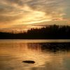
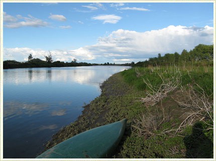
The mouth of the Yakima River on an unusually calm day. The Columbia can be ferociously windy. The day after we finished we saw winds of 30+ mph on the river.
Check out more of Scott’s adventures on his canoe blog: canoepost.blogspot.com and his website: scottschuldt.com