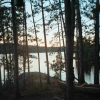
Woodland Caribou Provincial Park—Where Nature Still Rules
This is a place one is more likely to come across a woodland caribou, or hear the cry of a wolf than encounter humankind. It is an ancient, weathered landscape of haunting physical solitude and spiritual solace. A sojourn to the hinterlands of Woodland Caribou is a voyage through time. By canoe, one can follow the waterways of the Ojibway and journey past images of animals and shamans painted on stone.

Photo by John Fahlgren
Established in 1983, the Woodland Caribou Provincial Park is the 4th largest park in the Ontario Parks system. It is 486,235 hectares or about 1,150,000 acres, roughly half the size of the BWCAW. The park is classified as a wilderness and is located in Northwestern Ontario about 20 miles west of Red Lake and 60 miles north of Kenora. The Park was identified as one of the nine featured areas within Ontario’s Living Legacy Land Use Strategy (1999). These featured areas contain significant natural and cultural features and boast high-quality wilderness recreation opportunities. To learn more visit; http://www.ontarioparks.com
A Boreal Prairie Forest Wilderness
The Woodland Caribou Park is a unique mix of boreal and prairie ecosystems. The dry climate, well-drained plateau topography and proximity of the prairie have all contributed to a unique forest mosaic. In its complexion and composition the woodlands are mainly boreal (northern), with large strands of fire dependent, lichen rich, jack pine on the dry, sandy soils of the uplands. In the river valleys, around some of the lakes and on south facing slopes, where more favorable conditions of soil and climate prevail, white spruce, balsam fir, trembling aspen and balsam poplar form mixed stands with rich and diverse layers of shrubs and flowering plants.
Some of Ontario’s oldest rocks. The park lies on a relatively flat plateau of granite rock about 2.5-3 billion years old. Glaciers scoured, scraped and molded the bedrock. As the glaciers retreated the landscape was flooded by the waters of Lake Agassiz. Sands and gravel, deposited throughout ages of varying water levels, filled the lowlands and linear depressions. Today, the landscape is characterized by elongated lakes, erratic drainage patterns, abrupt changes in elevation, thin soils, granite bedrock outcrops and massive boulders.
Throughout the park there are remnants of the adjacent prairie. Prairie grey-stemmed goldenrod and prairie crocus are but two of more than 100 plants of a drier, generally prairie habitat found in the park. The term ‘Prairie Boreal’ reflects the shared similarity of the Woodland Caribou forests with the dry boreal forests of the adjacent prairie provinces rather than the wet boreal forests found elsewhere in Ontario. In addition to the prairie plants, more than 300 boreal species also thrive there. Of the 400-plus plants, 14 are considered provincially rare and 124 are significant to the region.
The Woodland Caribou forest is a mosaic pattern of fire succession. The park has never been logged, however, half of the park has burned within the last 30 years. Paddle any canoe route within this park and you will pass by forests in every stage of fire succession—from the black and soot of recent burns, to the sudden and colorful profusion of herbaceous growth that flourishes after a fire, to the slow return of a mature forest of jack pine or spruce. The ashes of the forests past are the soils that sustain forest renewal today.

A Wilderness Canoe Tripping Paradise
Over 1,100 miles of waterways weave a pattern of interconnected lakes and rivers ideal for canoe tripping. There are four primary river systems which include the historic Bloodvein and Gammon rivers as well as the Oiseau (Bird) and Haggart. These rivers along with the small meandering creeks connect the innumerable chains of small and large lakes. All the waters in Woodland Caribou lie within the Nelson River drainage basin and flow north to Hudson Bay. The general direction of water flow is from east to west. The exception is the Haggart River system that flows in a northwesterly direction while the water routes south of Haggart Lake flow in a south-southwest direction.
While paddling this park you can retrace the fur trade routes of the historic Hudson Bay and Northwest Companies or paddle a chain of lakes to places where few have ever passed. Woodland Caribou Provincial Park is a wild sanctum for the body, mind and soul.
Primitive signs mark the portages, creeks and overland routes. Woodland Caribou Park remains a wild area. Travel in this park requires reading primitive signs and navigating by compass. Blazed trees and rock cairns mark portages trails. Hiking over land and exploring off-route lakes can be part of a Woodland Caribou experience, adding a good challenge for the most experienced outdoor enthusiast.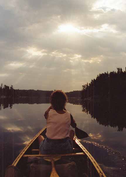
The rewards of this wilderness are sometimes found on stone. Onamin or wunnamin are Ojibway words for red ocher, a chalky red mineral that when mixed with animal and fish oils was used to record their stories in the form of pictures or writings found on rock faces throughout the park. These places are spiritually significant and should be treated with respect.
The many ‘writings’ (pictographs) in Woodland Caribou may tell wondrous and fascinating stories of Ojibway traditions and spiritual beliefs. Many of these writings are from 1,000 years past. They say that when you pass by a pictograph in Woodland Caribou Park, paddle slowly and quietly— “maybe you’ll hear a murmur or chant; the song of the healer resonating in the depths of your wilderness”.
It is customary, when encountering one of these writings, to make a small offering (tobacco was a traditional offering) and to ask for safe passage.
A park aptly named Woodland Caribou
The boreal population of forest-dwelling woodland caribou are listed as nationally threatened by the Committee on the Status of Endangered Wildlife in Canada. About 120 animals roam within Woodland Caribou Provincial Park. The group represents one of the largest concentrations in Ontario south of the Hudson Bay Lowlands.
Access, permits and fees
There are no roads or ranger stations within Woodland Caribou Park. Access points are few and limited by rough logging roads and adjoining waterways. Road shuttles are offered from Red Lake. Float planes are allowed to land in the park and can provide air shuttle service to and from the park’s interior. Permits are required; visitors will need either a day use permit or an interior camping permit. To obtain a list of fees and regulations visit the Ontario Parks User Fees page on their web site or contact the park office in Red Lake. All revenues generated from usage fees are used exclusively to support the Ontario Parks Provincial Parks Program.
Like the BWCAW in the early 1900’s, the Woodland Caribou Park is known to only a few. From 2002 through 2006 the average number of interior camping permits issued was 225 per season representing an average of 765 campers visiting the park from May to September each year.