Nanook River Summary
TRIP LOG: Submitted by Mel Baughman, May 2015
Victoria Island, Canada
July 2 – 22, 2000
Crew: Mel Baughman, Dan Godwin, Jerry Kemperman, Phil Larson, Robert McCoy, and Roger Schaub III
Route:
We flew via commercial airlines to Edmonton where our crew assembled from various points around the country. After lodging in a motel overnight, we continued our commercial air travel through Yellowknife to Cambridge Bay on Victoria Island in the Arctic Ocean, Nunavut, Canada. We camped by a river three miles out of town while waiting for our canoes to be delivered from an outfitter in Yellowknife. After waiting two days for canoes that never arrived, the friendly folks at Adlair Aviation loaned us three canoes plus life jackets. We bought paddles from the general store. Late in the afternoon we flew in a Twin Otter to the headwaters of the Nanook River and landed on a tiny esker on the north branch of the Nanook with 50 feet of “runway” to spare. After camping overnight we traveled downstream for 15 days (including two layover days) covering 95 miles and ending at the mouth of the river on the northern coast of Victoria Island. The next day a Twin Engine Otter landed on the gravel bar where we were camped and flew back to Cambridge Bay. We caught an afternoon commercial flight to Edmonton. There we stayed overnight again, then continued our flights home.
River Conditions:
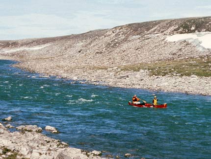
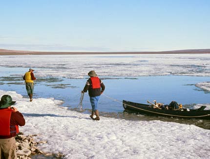
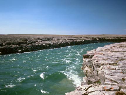
We planned our trip to be on the river just at the end of the snowmelt so there would be adequate water in the river. Our timing was good, although there still was ice on two lakes that we passed through. We portaged a total of 500 yards around two stretches of ice, but were able to find open leads next to shore for paddling the remainder of the ice-choked lakes. We also portaged a mile around a rapid on the left bank near the end of the trip. There were some other easy rapids, but the entire river, except for lakes, had a current. Many days were quite windy, although we were never totally wind bound. The river was 75 yards wide where we first launched, but four miles downstream, the north and south forks of the Nanook joined and the river became 150 yards wide. There were scattered small ice flows at the mouth of the river, but the pilot told us the pack ice was five miles further north. All things considered, it was a relatively easy river to paddle. Water was somewhat silty, especially in the beginning of the trip, but became clearer as we traveled downstream.
Campsites:
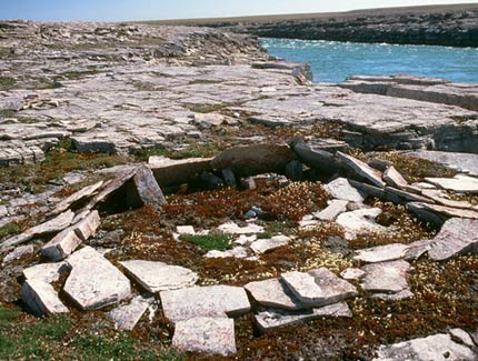
Campsites were relatively easy to find. Mainly we camped on tundra vegetation or on gravel bars. There was no evidence of previous campsites but there was one fishing outpost camp along the river. It was unoccupied at the time of our trip.
Topography:
The landscape was relatively flat with low rolling hills. We often could see a hill on the horizon as we approached from several miles away, only to discover that it was just 40 feet high. There were no significant cliffs or other rock formations.
Vegetation:
This was very barren tundra with ground cover only a few inches high and no trees. It was easy to hike wherever we wanted to go.
Insects, Fish, Wildlife:
Mosquitos and black flies were tolerable pests. We did not have a bug tent for shelter.
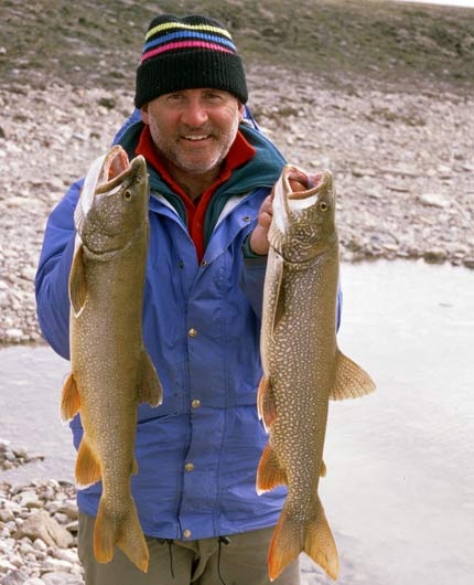
Fishing was good throughout the river for lake trout up to at least 10 pounds. We caught a couple of arctic char at the end of the river, but they were just beginning their fall migration upstream.
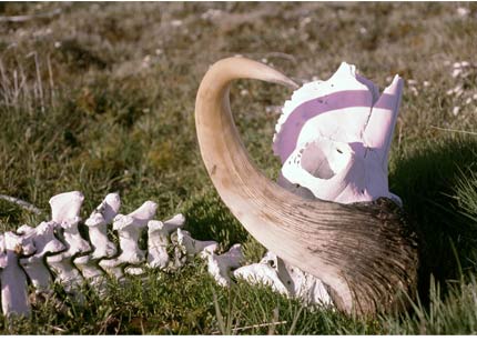
Muskoxen were very common and we saw a few dozen caribou in small groups. We also saw remains of seven dead muskoxen and some people took skulls home. We were able to get close to arctic foxes and arctic hares.
Canoes & Equipment:
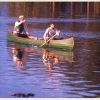
We paddled two Old Town Discovery 174s and an Old Town Discovery 169. Canoes were borrowed from Adlair Aviation. We had no spray skirts, but added lining ropes to each canoe. We did a small amount of lining. We used straight-shaft paddles purchased at the last minute at the local general store.
Topographic Maps (1:250,000): 77F Kagloryuak River, 77G Burns Lake, 77H Cape Stang
Charter Plane: Adlair Aviation Ltd., Box 111, Cambridge Bay, NT, X0E 0C0; (867) 983-2569; cambridgebay@adlair.ca; http://www.adlair.ca/
Approximate Average Cost Per Person: $2,102 including: $668 Charter air service, $1,036 Fly Winnipeg to Cambridge Bay, $181 Food/supplies, $127 Motel/restaurant/taxi, $33 Car gas/airport parking, $29 Radio rent, $28 Fishing license.
By Mel Baughman, Hayward, Wisconsin
For a complete journal with more details, contact the author—baughman@umn.edu.