Update: 8 Rivers North Expedition 2014 Trip Report
By Adam Maxwell
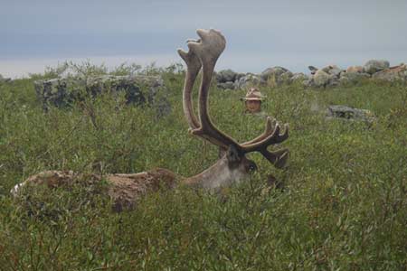
Adam hiding behind a rock to get up close to a Bull Caribou. Photo by Jake Bendel
In the summer of 2014 I was lucky enough to travel with a group of 5 other young explorers. Our route would take us into the arctic tundra of Northern Canada, but it would not be by means of air travel. Instead we chose to start in Saskatchewan on the Waterfound River. Our put in point was along Highway 905 as it crossed over the river. From our put in we traveled 920 miles through the boreal forest and arctic tundra on our way to Hudson Bay.
In doing so we had a chance to experience the transition between forest, taiga and tundra. It was amazing to watch the transition in flora and fauna, as well as the weather. I will expand on these transitions and the terrain we faced as we paddled eight rivers, many large lakes and two unnamed tributaries streams on our journey through the Canadian North. For more information go to The Trip Website HERE > or friend us at on Facebook at 8 Rivers North Expedition.
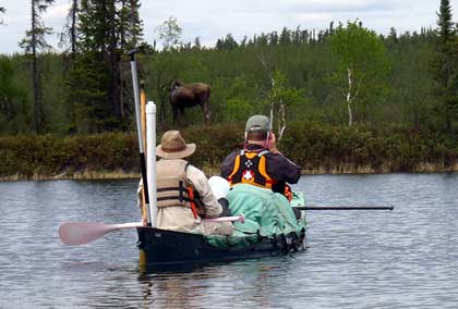
Adam and Alex paddling up to a moose. Photo by Jake Bendel
Waterfound River
ur trip began on the Waterfound, but our time on the river was short. During our 35 miles on the Waterfound River we were surrounded by thin spruce and birch forest; notable wildlife along the river included our first moose of the trip. The thin stands of small spruce surrounding the Waterfound was deceiving in that it appeared to be giving way to the barren grounds. This type of forest was gorgeous, but likely caused more so by sandy soil than our latitude. This type of forest continued on the Fond Du Lac River before making way to larger and denser forest on the Chipman and upper Dubawnt. The rapids on the Waterfound were frequent and long, but did not present many issues. They were all class one and often shallow making our primary concern finding deep channels.
Fond Du Lac River
The Fond Du Lac is a well-traveled river in Saskatchewan’s boreal forest. It is most known for its spectacular sandstone cliffs and the waterfalls that rage between them. Many of the most awe-inspiring sections of our route were on the Fond Du Lac. I will never forget the time we spent at Manitou falls and the wonderful campsites found along the river. Several larger rapids exist on the Fond Du Lac causing most groups to portage between 3 and 6 times. Two of these portages exceeded a half mile. Fishing was great along the Fond Du Lac offering the only walleye of our trip. Many moose and a few black bear were observed along shore. I was amused by the large numbers of surf scooter, which are a diving duck that I had not previously seen.
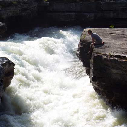
Kari sitting next to Manitou falls. Photo by Alex Compton
Chipman River
I struggle to call this a river as we spent more time portaging than paddling in this upriver section. This section started with 2.5 mile portage out of Black Lake. This portage left all of us limping around camp and looking rather pathetic as we finished hauling 50 days of food over it. The main portage was followed by six more portages which connected small ponds before we reached Chipman Lake and the Chipman River proper. This route is not traveled by many canoe groups, but is well maintained as the people from Black Lake travel it on snow machine. The forest and topography of this section felt more similar to Boundary Waters paddling than anywhere else on our route. It was surrounded by large birch and spruce, as well as basalt formations. Due to the drop pool nature of this river the challenges came in the way of portages rather than paddling up a swift current. Before reaching the Dubawnt River we would face 70 miles of lake paddling on Selywn, Flett and Wholdia.
This part was really wore us out, no one had the energy to take pictures
Dubawnt River
The Dubawnt is one of the “big three” arctic rivers flowing into Baker Lake. On the Dubawnt we noticed the most drastic change in our environment as we traveled out of the boreal forest and into the land of little sticks before we began to transition into the tundra. Even above the tree line as it was marked on our maps we experienced the occasional patch of short stunted spruce and thick willow. Along the Dubawnt we observed moose and black bear rather than musk ox and caribou. The birds of the Dubawnt were, however, a sign that we were moving north. Laplandish long-spurs joined us with their songs at each camp spot and parasitic jaegers flew overhead as we paddled. We began to catch grayling and lake trout and found very few northern pike. The section of the Dubawnt we traveled had far easier whitewater than the lower Dubawnt. We lined one ledge, but were able to run everything else in this section. The eskers along the shore in many sections were a highlight of this section and provided my favorite campsite of the journey.
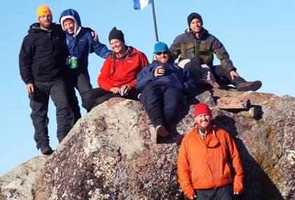
Tyrell’s Cairn group photo. Left to Right (on rock) Ryan, Kari, Tessa, Adam, Jake and Alex standing in front. Self timer photo by Alex Compton
An unnamed tributary with a little water
This is one of those times were I found myself wondering why I had picked a route to hop watersheds and make things more difficult than need be. Now that it is over I am grateful for the route we chose and the unique experiences that were ours on the smaller less traveled waterways of the Far North. On our first day heading toward the Kazan River we made only seven miles as we faced shallow sections of river and several portages in areas that we expected to paddle. We were left exhausted and wondering if conditions would improve in the days to follow. The next day we again worked hard and struggled to make miles early in the day. In the evening we finally finished the shallow tributary river and made it to a large lake named Kamilukawauk. We were lucky enough to experience no wind on one of our largest lakes. We paddled well into the night and finished the lake around two o’clock in the morning. It was an unbelievable evening as the sun set and we continued making quick miles on a large glass calm lake.
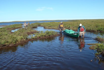
Alex and Ryan walking a canoe on first tributary. Photo by Jake Bendel
Nowleye River
The Nowleye River was short and a large part of our time was spent wind bound on Nowleye Lake. During this section we experienced our first full day of seeing no trees. We also saw our first herd of musk ox and our only wolverine. Nowleye Lake challenged our group with many bay crossings and cold rainy weather. After leaving Nowleye Lake we faced one of our largest rapids of the trip. It was navigable by running the top to an eddy just before a large wave train. We lined the wave train and ran the final section of whitewater. It was a fun set that tested our skills in reading water, decision making, lining and paddling.
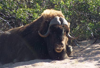
First musk ox of the trip along with black fly companions. Photo by Alex Compton
The Kazan
Our first day on the Kazan was spent wind bound on Angukuni Lake, our fourth wind bound day in the last week. Due to these delays we were forced to travel quickly and make up for lost time on the Kazan. The Kazan was perfect for this as the river flows quickly with many long and easy class one rapids. With the exception of a few mandatory portages we were able to read and run most rapids without getting out of our boats. We saw musk ox every day and our first caribou of the trip while traveling the Kazan. Each day on the river and even on the large lakes of the Kazan we traveled close to 30 miles. We did, however, make time to enjoy the many signs left behind by the rivers former Inuit inhabitants. We experienced some of our best fishing on the Kazan as many lake trout and grayling were caught beneath rapids. On Yathkyed Lake we were blessed with calm weather and beautiful days. Beginning at Yathkyed Lake we did not see another tree for the remainder of our trip. Although our time on the Kazan was short it will not be forgotten. The river amazed me and left me wanting more. A trip from Kasba Lake to Baker Lake is certainly in my future.
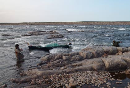
Adam and Tessa lining a set. Photo by Jake Bendel
Our second tributary stream
After eight portages out of Tyrell’s Arm on Yathkyed Lake we paddled our second unnamed tributary to eventually meet the Ferguson River. Once again we were met with shallow water causing us to spend many hours dragging our canoes over rocks and shallow water. Trip notes we had from previous trips labeled many rapids as runnable, however, we were forced to drag our boats over shallow rocks and even portage most of these sections. The group began to fear that if we did not pick up more water in the Ferguson River that we would certainly not make it to Whale Cove in time for our flight. The highlight of this section was the long awaited caribou herd. Our first encounter occurred as we watched roughly 2,000 members of the Kaminariak herd appear from over a ridgeline and fill the valley we stood in. In the 3 weeks that followed we saw dozens of caribou each day. It was amazing to see these animals fill the many interconnected trails that we had been observing and portaging over since our arrival on the tundra.
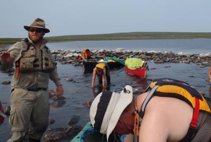
Slow and steady is the only way to go. Adam and Alex in front, Kari and Tessa crawling on slippery rocks. Photo taken by Jake Bendel
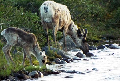
Mom and calf caribou getting a drink. Photo by Alex Compton
Ferguson River
The Ferguson River seemed to be a unanimous favorite part of our route. It was a small and untraveled river surrounded by large rock formations and tons of caribou. Its shores were also marked by countless Inuit sites, including meat caches, graves, tent rings and kayak rests. It was a surreal experience to feel so alone in a region that was clearly inhabited by many people in decades and centuries past. Although the Ferguson began as a very shallow river it soon picked up volume. The rapids became large and several portages were required. As the river picked up volume the sense began to set in that we were headed to the Bay. The water we traveled had come from far and wide and was becoming more concentrated as it took its final decent. Along the Ferguson we faced a large tundra fire which nearly blocked our route. Over fifty miles from Hudson Bay we encountered our only seal of the trip. The Ferguson can also be accessed by plane from Baker Lake and traveled for shorter trips of 2 or 3 weeks.
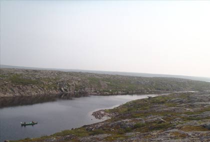
Adam and Tessa approaching yet another shallow section on the upper Ferguson. Photo taken by Kari Smerud.
Wilson River
13 miles before reaching Hudson Bay we chose to once again jump watersheds and join the Wilson River. This decision was made because it resulted in a shorter and more protected paddle on the Bay, before reaching the town of Whale Cove. We saw the only polar bear of our trip sitting on a large rock formation 8 miles away from the coast. Our last night was spent in a cabin a couple miles from the coast. In the last five miles of the Wilson River there are many cabins, including a large group at the mouth of the river. A road runs between these cabins and the town of Whale Cove. This offers groups an alternative to paddling on the ocean. The Wilson was a fun whitewater run to end our trip with. Of the many small ledges on this section of river, most of them were runnable by following very tight lines down the main V’s. Others requiring lining and potentially portaging. One of the largest ledges is at the mouth of the River.
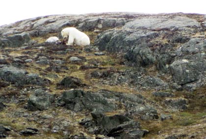
Polar bear enjoying a meal. Photo by Alex Compton
Wilson Cove on Hudson Bay
Although this cove is very sheltered it can still produce very large waves on windy days. Due to high winds and our plane schedule, we arranged a motor boat ride into town. This option saved us from becoming wind bound and allowed us to meet some amazing locals in Whale Cove. The hospitality we experienced with the family was amazing and the best possible way we could have ended our trip. Along the coast we still saw several caribou and began to see eider ducks. We arrived in Whale Cove before the migrating beluga whales, but other groups may get a chance to paddle with whales if they arrive in late August or early September. More frequent wind may be a down side of this option.
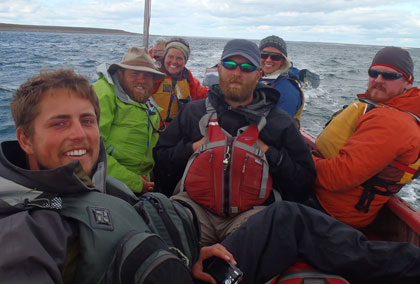
The crew getting a ride to Whale Cove. Photo by Eva Voisey (Wife of boat driver and host in Whale Cove)
The way home
By planes, trains, buses and automobile we made it home. Scheduled flights depart Whale Cove daily. We chose to fly to Churchill and train to Winnipeg. However due to a derailment of the train we ended up taking a bus part way to Winnipeg, where we meet friends and drove home.
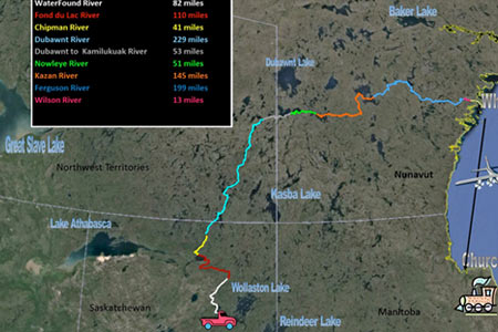
Trip Log (Approximate miles)
| Waterfound River | June 18-19 | 35 miles |
| Fond Du Lac River | 19-28 | 135 |
| Chipman River | 28-1 July | 40 |
| Dubawnt River | July 1-13 | 230 |
| Tributary | 13-14 | 20 |
| Nowleye River | 14-19 | 35 |
| Kazan River | 19-26 | 150 |
| Tributary | 26-30 | 30 |
| Ferguson River | 30-10 August | 200 |
| Wilson River | August 10-11 | 15 |
| Hudson Bay (Wilson Bay) | 11 | 20 |
8 Rivers North Expedition 2014
In mid-June, the team of Adam Maxwell, Ryan Ritter, Jake Bendel, Tessa Olson, Alex Compton and Kari Smerud will paddle over 900 miles on eight river systems north to the Hudson Bay and the barren lands of Nunavut.
Their Mission:
“To share our stories of traveling Northern Canada’s pristine water ways, in order to educate people about wilderness and the importance of preserving it, and to inspire more young people to paddle. As we travel on this adventure we want to engage in both wilderness and cultural experiences. We aim to share our adventure through presentations, blog posts, social media and our web page.”
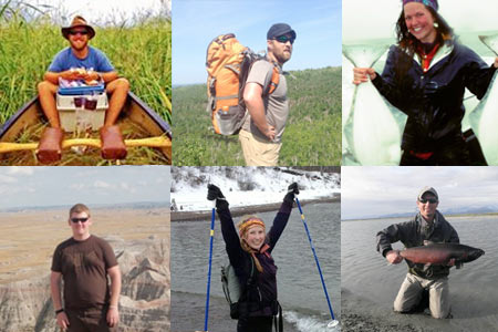
Adam Maxwell, Ryan Ritter, Tessa Olson Alex Compton, Kari Smerud, Jake Bendel
The Route:
On June 18th, 2014 the crew departed from Duluth, Minnesota and headed north to Waterbury Lake in Northern Saskatchewan. From there they will paddle to Hudson Bay starting on the Waterfound River and following 8 rivers north.
These rivers include the Waterfound, Fond Du Lac, Chipman, Dubawnt, Nowleye, Kazan, Ferguson, and Wilson. This route traverses boreal forest, taiga and arctic tundra, and ends with a thirty mile paddle along the tide flats of Hudson Bay. They hope to explore the unique ecosystems and historical sites, catch fish and see musk ox and beluga whales along the way. The Wilson River drains into Hudson Bay where they will end their paddle in the Inuit community of Whales Cove, Nunavut CAN. From there the crew will take a plane to Churchill, Manitoba and journey home to Minnesota.
Canoeing.com is a proud Sponsor of the 8 Rivers North Expedition.We will check in with the paddlers and post follow-ups on the trip here, follow our Facebook page for updates.
Follow the Expedition web site >
Read an interview with the paddlers on Canoe & Kayak >
You may also like: Rails to Whales 2012 >
