The Minnesota State Water Trail System: Celebrating 50 Years of Paddling

Big Fork River at the Craigville start point.
2013 is the 50th anniversary of the Minnesota State Water Trail system. This is a system of recreational routes on waterways that are managed by the Minnesota Department of Natural Resources (DNR) for canoeing, kayaking and camping. The system includes a network of public water accesses and campsites. Back in 1963 the Minnesota, St. Croix, Big Fork and Little Fork Rivers were legislatively designated as “Canoe and Boating Routes”. This was the beginning of the Minnesota State Water Trails. This year, from June 7 – 9, four accomplished paddlers—Timothy Eaton, Susan Plankis, David Burkhart and myself—decided to celebrate this anniversary by paddling one of these original four rivers.
Since none of us had paddled the Big Fork, and since the Big Fork is tucked away in northwestern Minnesota and has a bit of a mystique, it became the river of our choice. Our time was limited so we chose to paddle from Craigville to Big Falls, a journey of about 54 miles. The DNR maintains the Big Fork all the way from headwaters at Dora Lake to Rainy River, a distance of 170 miles.
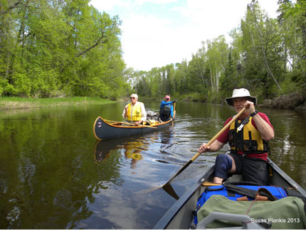
Dave Burkhart, Tim Eaton and Rob Kesselring
The Big Fork runs through the lake bed of the old glacial Lake Aggassiz. Because of this, the topography is flat and the current sluggish. There are two notable exceptions, Big Falls and Little American Falls, both of which are bumpy drops that at typical June water levels are mandatory portages. The peat lands drained by the Big Fork give the river a rich walnut color. We observed paddlers treating and drinking water straight from the river, but the DNR recommends that campers carry potable water and that is what we did. Water containers can be replenished at a spring at Johnson’s Landing (mile 67.5) but the flow was underwhelming when we visited it, less than 1gpm.
Unlike many of the rivers in the Minnesota State Water Trail, the Big Fork has a wilderness vibe. Miles can pass with little sign of human caused disruption. Instead paddlers witness slippery banks choked with vegetation, dank swampy smells and the haunting winnowing of Jacksnipe. Although not as friendly a refuge as some other Minnesota Rivers it is a route where campers can escape the maddening crowds.
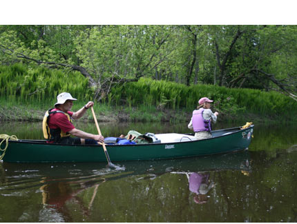
Rob Kesselring and Sue Plankis.
Mosquitoes were plentiful this season. The river was wide enough to avoid their onslaught by keeping to the center of the channel. Lured away by a beaver, Sue and I ventured up one of the largest river snyes. Turtles slid like crocodiles into the still waters, nesting warblers were silenced by our invasion and the whine of mosquitoes contributed to a melancholy mood. We were later admonished by a local pistol-packing rancher who warned us that the particular backwater we paddled is avoided by residents, especially after darkness falls. Strange noises have emanated from the surrounding bogs and some believe it is the voice of Bigfoot.
There are about a dozen designated campsites on the 170 mile route. Most of the ones we used or passed were clean, spacious and had stout tables, fire grates and latrines. Camping is permitted on any of the public land along the river, but at June water levels, carving a site out of the bush would be challenging. We opted to camp at designated sites on soft grassy, flat spots that took tent pegs well.
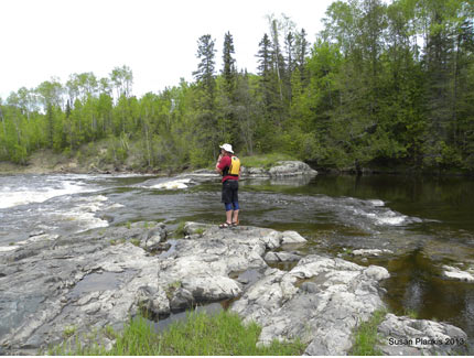
Scouting American Falls
Tim cooked gourmet meals over a LittleBug twig stove and we dined beneath a CCS mosquito enclosure that fit over the picnic table perfectly, making us feel as if we were on a comfortable safari. We did not drift with current, but instead paddled. The canoes clipped along at about 4 mph. This gave us plenty of time both evenings at camp for birding, story telling and card playing.

The CCS bug enclosure
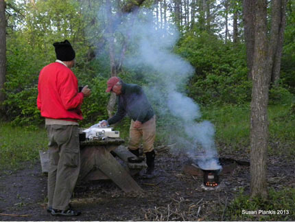
Cooking on a Little Bug twig stove
The river is rich in wildlife. Otters, beaver, mink and deer are common and a wide variety of birds were also observed on our three-day journey. Shuttle services are available to streamline the logistics. We chose to use the excellent services of Rivers North Outfitters located in Big Falls. Contact Bill Gorden at 1-877-481-2569; he is very knowledgable about the put-in and take-out locations along the river, as well as campsite and current river conditions. More information at http://www.riversnorthmn.com.
Explore Minnesota’s Rivers and Streams in the Canoeing.com Destination Guide >
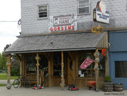
Rivers North Outfitters in Big Falls


