Shop Navigation Tools

Item:  

Showing 1–18 of 87 results

Added to wishlistRemoved from wishlist 0
Add to compare
Woodland Caribou Provincial Park and Area Map
Waterproof. At 1:110,000 scale our map has extraordinary geographic detail plus access points, portages, island names, lake elevations, route helpers and many other helpful features. It also covers areas outside the Park including the nearby Town of Red Lake and the huge body for which it was named.
$20.00
Compare
Added to wishlistRemoved from wishlist 1
Add to compare
Quetico Provincial Park & Area Map
Official Map. This 1:125,000 scale planning map has extraordinary geographic detail plus ranger stations, entry points, portages, island names, lake elevations, historic attractions and many other features. Also covers areas outside the Park including the northern edge of Boundary Waters Canoe Area Wilderness. Waterproof.
$20.00
Compare
Added to wishlistRemoved from wishlist 0
Add to compare
Wabakimi Provincial Park Planning Map
At 1:150,000 scale, this illustrative map is intended to be used as a planning map and is best suited as an overview to this vast wilderness. The map will provide you with very useful information on the canoe routes connecting its 10,000 lakes, rivers and streams. The map shows canoe routes, portage locations and distances.
$20.00
Compare
Added to wishlistRemoved from wishlist 3
Add to compare
Temagami Canoe Routes Planning Map
Waterproof. 1:80,000 scale, and 24x25", with a contour interval of 20m, has considerably more detail than government topos or any other map of the area. Our map covers the Northeast quadrant of the main region, and is bounded by Maple Mountain to the west, Latchford and Hwy 11 to the east, Wakimika Lake, Sandy Inlet and Red Squirrel Road to the south and the Spray Creek/Big Spring Lake/Montreal River junction to the north.
$12.50
Compare
Added to wishlistRemoved from wishlist 1
Add to compare
Garmin TOPO Boundary Waters
Download
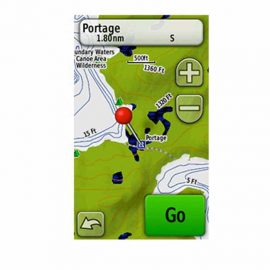
Get highly detailed inland lake and topographic maps for the Boundary Waters Canoe Area Wilderness. These maps include freshwater lakes and rivers, high-definition shorelines, underwater depth contours, terrain contours, elevations, summits, portages and camping areas.
$99.99
Compare
Added to wishlistRemoved from wishlist 0
Add to compare
Garmin inReach Explorer+ Satellite Communicator
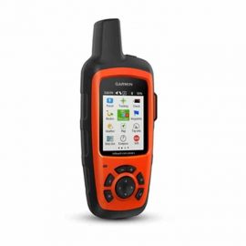
Roam far and wide without worrying your loved ones back home. The Garmin inReach Explorer+ Satellite Communicator allows 2-way messaging, tracking and interactive SOS from anywhere in the world.
$450.00
Compare
Added to wishlistRemoved from wishlist 1
Add to compare
SPOT Gen3 Satellite GPS Messenger
With the SPOT Gen3 Satellite GPS Messenger, you can reach emergency responders, check-in with family or friends, share GPS coordinates and track your adventures, all at the push of a button.
$149.95
Compare
Added to wishlistRemoved from wishlist 1
Add to compare
ACR Electronics ResQLink+ GPS Personal Locator Beacon
The buoyant ACR Electronics ResQLink+ GPS personal locator beacon offers all the features of the ResQLink—plus it floats! It's ideal for boaters, anglers and anyone else on or around the water.
$269.00
Compare
Added to wishlistRemoved from wishlist 0
Add to compare
Garmin Oregon 750t GPS
With preloaded trail maps, the Oregon 750t GPS offers powerful navigation right out of the box. Explore deep canyons and dense forests with a redesigned antenna that offers better reception than ever.
$550.00
Compare
Added to wishlistRemoved from wishlist 2
Add to compare
Garmin GPSMAP 64 GPS
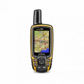
The waterproof, full-featured Garmin GPSMAP 64 GPS handheld unit boasts a high-sensitivity receiver that works with both Russian GLONASS and U.S. GPS satellites for superior reception and navigation.
$250.00
Compare
Added to wishlistRemoved from wishlist 0
Add to compare
Garmin GPSMAP 64st GPS
Preloaded with TOPO U.S. 100K mapping, the Garmin 64st boasts wireless connectivity and a high-sensitivity receiver that works with Russian GLONASS and U.S. GPS for superior reception and navigation.
$350.00
Compare
Added to wishlistRemoved from wishlist 0
Add to compare
Adirondack Paddler's Map
Waterproof. The Adirondack Paddler's Map is a waterproof, full-color shaded relief map showing portages and campsites for canoe and kayak travel. Covering The Saranac Lakes, St. Regis Wilderness Area, Santa Clara Tract, Five Ponds Wilderness, Whitney Wilderness, Raquette River, & Cranberry Lake.Wild Forest
$19.95
Compare
Added to wishlistRemoved from wishlist 0
Add to compare
Adirondack Paddler's Map
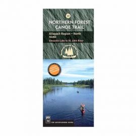
Waterproof. Navigate your way through the final section of the Northern Forest Canoe Trail—from Umsaskis Lake to the historic St. John River—with NFCT Map 13 and paddle in waters first paddled by Abenaki hunters, past early European settlements, and along shorelines that hold ghost stories and relics of logging days.
$9.95
Compare
Added to wishlistRemoved from wishlist 0
Add to compare
Northern Forest Canoe Trail Map 12: Umbazooksas Stream to Umsaskis Lake
Waterproof. Navigate your way through the second-to-last section of the Northern Forest Canoe Trail—from Umbazooksus Stream to Umsaskis Lake—with NFCT Map 12 and explore the forested shorelines, interconnected waters, and rich history of the Allagash Wilderness Waterway.
$9.95
Compare
Added to wishlistRemoved from wishlist 1
Add to compare
NFCT Map 11: Moosehead Lake to Umbazooksas Stream
Waterproof. Navigate your way through the eleventh section of the Northern Forest Canoe Trail—from Moosehead Lake to Umbazooksus Stream—with NFCT Map 11 and explore dramatic features and rich history of north-central Maine.
$9.95
Compare
Added to wishlistRemoved from wishlist 1
Add to compare
Northern Forest Canoe Trail Map 10: Spencer Stream to Moosehead Lake
Waterproof. Navigate your way through the tenth stretch of the Northern Forest Canoe Trail—from Spencer Stream to Moosehead Lake—with NFCT Map 10 and explore the woods, water, and wilderness of the Jackman and Rockwood communities.
$9.95
Compare
Added to wishlistRemoved from wishlist 0
Add to compare
Northern Forest Canoe Trail Map 9: Rangeley Lake to Spencer Stream
Waterproof. Navigate your way through the ninth section of the Northern Forest Canoe Trail—from Rangeley Lake to Spencer Stream—with NFCT Map 9 and take in the stunning views of the Bigelow Preserve, the Appalachian Trail, and Grand Falls.
$9.95
Compare
Added to wishlistRemoved from wishlist 0
Add to compare
Northern Forest Canoe Trail Map 8: Umbagog Lake to Rangeley Lake
Waterproof. Navigate your way through the first Maine section of the Northern Forest Canoe Trail—from Umbagog Lake to Rangeley Lake—with NFCT Map 8 and explore lots of undeveloped, conserved land and sensitive wildlife habitats.
$9.95
Compare


All prices are Manufacturer's Suggested Retail Price, subject to change, see manufacturer web site for details. Prices listed in U.S. Dollars.

Canoeing.com
Login/Register access is temporary disabled
Compare items
  • Total (0)
Compare
0