Farthest North 58°45’
TRIP LOG: Submitted by Craig Norell, September 10, 2007
It was Friday evening about 8:00 o’clock SASKATCHEWAN time and we were negotiating the last part of a 400 km gravel road that terminates at Points North Landing, a transportation hub for mineral exploration in Uranium country.
It was also silflay time for the local cottontail population, socializing at the shoulders, we stopped counting at sixty.
That night we were the sole occupants of an abandoned provincial park on Wollaston Lake, home of the world record lake Trout.

An early start the next morning on our way to the dock at Osprey Wings Air Service, resulted in a wrong turn and an abrupt stop at the locked gate of the Rabbit Lake Uranium Mine. After a terse discussion with my navigator we turned our backs on this monument to Man’s Complicity in His Own Destruction and continued on to Points North.
It is not a community. There’s no store, no public services, one gas pump, one runway, and one float plane service. People here are on a variety of work schedules trading a good pay cheque for a number of continuous working days IN for a smaller number of continuous days OUT. Most of the commuting is by air.
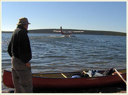
When we checked in at the office we were told there was a problem with the Beaver and it might be some time before we could leave for the Waterbury Lake put in. We unloaded our gear at the dock and while selecting a red Royalex Prospector from Churchill River Outfitter’s stock of two boats we were told we would be going in with the Twin Otter!
In this beast you sit in a single seat next to your boat filled with your gear. It is all carry-on baggage. We had a crew of two with the newbie in the left hand seat being closely watched by the veteran on the right.
The landing approach at the end of the thirty minute flight gave us a view of the rapids of the Waterfound River as it leaves the northwest end of Waterbury Lake. We were dumped from the rear of the float onto a cobblestone beach in front of two ancient cabins where someone had stuck a Hilton Hotel access card in the door jamb.
We quickly packed the canoe and did the traditional wet feet pushoff thinking we were leaving civilization behind…but around the corner we meet two boats, each with a guide and two fishermen and have this disjointed conversation:
Where are you guys going?
To Waterfound Bay.
?? I’ll have to look at your maps…
We don’t have any maaaps…. as we drop down the first rapid.
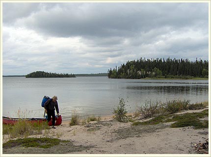
If you’re used to paddling shield country, this is a different landscape, dominated by steep sloped lichen covered eskers with the occasional sandstone outcrop and parklike jackpine benches 1 to 3 meters above the waterline. The best campsites are called beach and bench. You’re in tent and tarp heaven.
We were on a tight schedule and always looming in the background was the 7:00 am pickup time at Waterfound Bay where the Waterfound River joins the Fond du Lac River on it’s way north to Lake Athabasca.

Because we were anxious about making this deadline we didn’t unpack the fishing gear until day two, so we stopped at the first rapid that offered a fishable shoreline. My partner meanwhile (that Harpy) had been berating me and the Gods about the absence of onion and potato for the pending fish dinner. With bow rope in hand and searching for a secure tie point, she suddenly bends over and with a sly smile holds up a large Spanish onion!
A few more steps amidst the river boulders she discovers a minimally gnawed baking potato! Within ten minutes we have two 1 1/2 lb grayling to complete the repast.
We had four days of fine to good weather with a couple of 2 to 3km point to point crossings on the lakes in intermittent whitecaps. On the fifth morning we woke to light rain turning the water’s surface into bubbling diamonds, a drop in temperature, a headwind and 20km to go to the pickup point. We had breakfast al fresco under the tarp and quickly packed up our wet camp and headed down river.
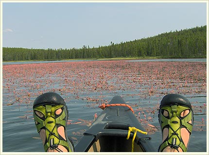
I’m going to blame early onset Alzheimer’s, I packed my fleece jacket rather than wear it under my rainsuit and went barefoot in my techamphibians. By late morning I’m starting to shiver, even with the wool toque and gloves, and I’m thinking why is my partner warm and happy, maybe I’m not working hard enough. An hour later with the continuing wind and rain, I know I’m in trouble and we eddy out near a tight group of spruce trees. We do a small A-frame tarp setup, crawl under and get the stove going with hot chocolate and Knorr soup (with real cream added). After a quick change including the fleece jacket and wool socks I’m back to my normal body temperature. If you do get into trouble none of the outfitter’s cabins are locked and with a grateful attitude they can be a safe dry haven.

We were picked up on the beach by the back-in-service Beaver and given a 15 minute informative lesson on tying on a canoe. The return flight was 40 minutes under a low ceiling of about 800 feet. When we were taxiing up to the dock I notice my partner sorting through the contents of our small waterproof bag.” Hon, here’s your car keys and your wallet with your drivers license, your health card and your mastercard…we’re back to the mundane.”
THE HIGHLIGHTS
A close encounter with a pack of five large, healthy wolves on the drive in. They seemed to have a problem with who should lead the exit from the roadway, you first…no you go…oh alright.
The potato, onion thing, a close encounter of a different kind.
Rounding a corner in fast water/rapids and coming face to face with a five foot tall unconcerned mature Golden Eagle giving you that “you’ve disturbed my fishing glare.”
This happened twice!
My partner who enjoys breaking the rules, landing a 3lb whitefish on a red and white spoon at the legendary walleye hole below Durant Lake.
Have your camera ready for the curious mink patrolling the shoreline and the huffing and snorting otters singly or in family groups.
THE NOT-SO-MUNDANE LOGISTICS
105km of evenly divided lake and river travel with
15 R1 rapids
9-10 R2 rapids
And 1 R3 rapid
Some of the R1’s combine for exciting runs of 500 to 1400m with one 4km stretch
We ran all the R2’s and I portaged that 80lb Royalex as far as I could around the R3 (Ledge-o-matic). I ran the three sets below solo with the heavy pack and food barrel up front to make for an easy carry.
There’s not a plethora of good campsites and if you’re not careful you can end up on the beachfront with water two feet from your front door
(It was a long day and a quiet night).
Points North Landing is 800km+ from Saskatoon
Flyin costs
$600 from Points North to the northwest end of Waterbury Lake
(You can drive to the south end of the lake via the Cigar Lake Mine Road but good luck finding someone willing to do the shuttle)
$700 from the west end of Waterfound Bay to Points North
Canoe Rental
$215 the weekly rate from Churchill River Outfitters
————————————————————————————-
Resources:
The reference for this route was taken from Laurel Archer’s Guide to Fifteen Wilderness Rivers: ‘Northern Saskatchewan Canoe Trips’ Boston Mills Press
Copyright © 2007
Craig Norel
”


