The first thing you’ll notice about the new official Woodland Caribou Provincial Park (WCPP) map is the Adventure Map® series style/branding. For the most part, the new style brings positive enhancements to information within the older WCPP map (now out of print).
The new map, like the old map, covers the entire 4,862 hectares (1.2 million acres) of the Provincial Park and clearly shows the five newly added or annexed additions; North Paishk, Paishk, Foley, Anchor and Sydney-Rowdy. These land additions, thanks to the efforts of Park Superintend Doug Gilmore and staff over the last few years, allows for more access to both the park and the endless canoe route possibilities within this Boreal Forest wilderness area.
The new map will make planning a trip a little easier, at least on your eyes
- there is better contrast between the water and landmasses colors
- the map’s legend and universal symbols are consistent, and easy to read
- the map’s scale, at 1-110,000, brings a little more detail into view
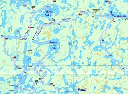
The map features over 2,000 km (1,200 miles) of canoe routes and includes newly added routes as well as planned routes currently under consideration and development. The portages are clearly marked and will show you the way. But in the legend, and on the map, you’ll find a new symbol titled ‘route helper’– it’s a pink line that crisscrosses the Park from east-to-west and north-to-south showing you the routes. This may be helpful at first read, as to where-to-go, or to plan a route, but after a time I found the route-finder a little more annoying than helpful.
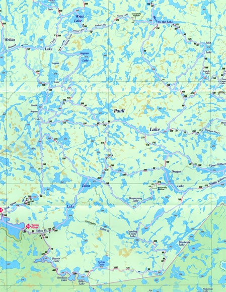
Main map area.
More features… once you’ve determined a route there is a handy 1-50,000 Topo Index included on the front side of the map to assist with planning and acquisition of larger scale topo maps. From my own experience of twelve trips into the Woodland Caribou Park, in addition to the Adventure Map, the more detailed topo maps are essential for finding your way in the event of changing your route or bushwhacking along the way.Access points…on the map you’ll see 20 access points into the Park with all but 5 of these accessible only by air or canoe. Entry points with road access and official parking include; 19–Leano Lake, 12–Hjalmar Lake via Onnie, 11–Johnson Lake and 9–Lund Lake. Entry point 10–Trout Bay is accessible by towboat service from Red Lake.
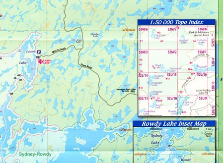
Map detail.
She pays close attention to their skill levels, and if unsuspecting canoeists are headed for the Falls Chain she sets them straight. Water levels can change dramatically along the chain of waterfalls, making portage landings hard to find and exposing inexperienced paddlers to strong currents. Janice has been known to steer beginners to other, safer routes because above all, she wants people to understand the power of nature.
There’s more… on the reverse side of the Adventure Map is more information about each access point, about the Park itself, the natural history, the Boreal Forest, the Woodland Caribou (the animal, not the park), Fish and Fishing, the river systems that run throughout the Park including the Bloodvein River and the Canadian Heritage River System. Reading the backside of this map is the best way to begin planning your first, or even thirteenth, visit to the Park.
Location map.
One more thing …the WCPP Adventure map is waterproof, and available for purchase online, click here


