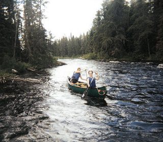
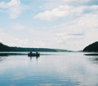
Wabakimi Provincial Park is above all else remote. With only about 700 backcountry visitors a year to its 2.3 million acres (892,000 ha)—as much territory as the Quetico and Boundary Waters Canoe Area Wilderness combined—there is less than 1/30th of the crowd. Big lakes abound, but Wabakimi is known for its many rivers. Within the park are the Allanwater and the Ogoki, and along the boundaries are the Albany, Brightsand, and Kopka rivers. There are several lodges and outpost camps, but no roads, so you can paddle in, fly in, or even ride in on the Canadian National Railway that runs between Savant Lake and Armstrong. The other nearest towns with good services are Sioux Lookout, Ignace, and Thunder Bay. No matter how you get there, Wabakimi is an incredible place to take extensive trips, immersing yourself in the isolation and splendor of the Canadian backcountry.
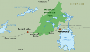
Jump-off Points:
• Armstrong
• Savant Lake
FEATURED SERVICES:
 Wabakimi Canoe Outfitters and EcoLodge
Canoe trips and eco-tours into Wabakimi Provincial Park. We're experts in custom canoe tripping and Outpost fishing trips. Choose from guided or unguided trips and full or partial outfitting. All of our trips are custom planned, and our highly experienced staff and guides will set you up with the trip of a lifetime! Address: 856 North Vickers Street, Thunder Bay, ON P7C 4C1 Phone: 1-807-583-2626 www.wabakimi.com
 Park & Permit Info
Wabakimi Provincial Park is big and wild–just ask the woodland caribou that make their home there! But, it’s relatively accessible and well supported with outfitters and online resources. General park information is available via its Ontario Parks web site and the Armstrong Resources Development Corporation also maintains a fine web site that will lead the savvy paddler towards lots of great information–from the history and ecology of the region to outfitter and guide contacts.
Groups traveling in Wabakimi Park are allowed no more than 9 people and they are encouraged to practice Leave No Trace camping. Backcountry camping fees for Canadian residents are $5.09 per youth, per night and $10.17 per adult, ($8.14 per senior) per night. For non-Canadian residents they are $6.50 per youth, per night and $14.97 per adult, per night. Permits are available in Armstrong, Ontario from Huron Air Outfitters, Mattice Lake Outfitters (Wabakimi Air), and Wildwaters Nature Tours & Expeditions Ltd (also known as Wabakimi Wilderness Adventures). If you start your trip from Savant Lake, Ontario you’ll have to pick up your permit elsewhere. Fees may change, so be sure to check the Ontario Parks fees web page for current information.
Wabakimi Park Permits are available online at https://reservations.ontarioparks.com/
The lodges and outpost camps in Wabakimi are scattered throughout the park. You should expect to encounter these and the motorboats and aircraft associated with them in your travels. However, the park is vast and in comparison to Quetico Provincial Park, you will find fewer people.
Visitors should be aware that there are no roads or facilities in Wabakimi Provincial Park. There is a small, unsecured parking area at Little Caribou Lake, but space is limited. If you plan on driving, it’s best to find an outfitter who can help you arrange for parking and transport.
Most visitors enter the park by rail, float plane, or canoe. Via Rail goes westbound from Armstrong on Sunday, Wednesday, and Friday mornings, and goes eastbound from Savant Lake on Sunday, Tuesday and Thursday evenings. They will drop off or pick up canoeists in the park at ‘special stops’ designated by no more than an unmarked portage trail. Thankfully, they offer good directions for arranging special stops on their web site. It should be mentioned that the baggage car gets very full some days, with the potential that your canoe won’t fit, so be sure to have a back-up plan and always make reservations.
Via Rail: Directions for Arranging Special Stops
 Fire Information
Fire condition information is available via the Ontario Ministry of Natural Resources or by calling the park office at 807-475-1634.
In 2005 there were two wild fires in the park. One burned approximately 3,890 acres (1,574 ha) on the south shore of Wabakimi Lake and the other burned about 5,748 acres (2,326 ha) east of Aldridge Lake.
 Maps & Routes
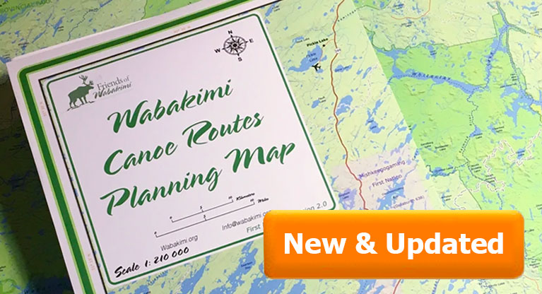
The best map for the region is the official Wabakimi Park Map here >
Published by the Wabakimi Provincial Park in conjunction with the Ministry of Natural Resources this canoe routes planning map highlights over 2,200,000 acres of remote wilderness including the original park, 155,000 hectares regulated in 1983, and the additional 737,000 hectares added in 1992.
There are no guidebooks for the area yet, so plan to navigate with topographical maps or with advice from local outfitters or park officials. Natural Resources Canada hosts topographic maps online, but they don’t sell them to the general public. Maps can be purchased online from Map Town Ltd., based out of Calgary. Most area outfitters carry a park overview map and 1:50,000 scale topographic maps, as well as the occasional Section Sheet, which has details on portages. Also check out the Wabakimi Project’s section on Canoe Route Maps, which will soon have maps specifically for canoeing in the Wabakimi area.
 History
Evidence suggests that the Wabakimi region has been populated for 7,000 years. The portage trails in the park today are simply the modern manifestations of the long-used routes through the area. Today the trails are managed by two First Nation crews: one out of Armstrong and the other from Collins, Ontario. More experienced crewmembers have spent years traveling in the park, talking to Elders and trappers. Their knowledge of the land, the park, and their culture is inspiring.
 Ecology
Wabakimi is best-known for the 300 or so woodland caribou which make their home among the lichen-rich granites of the park. To protect caribou calving areas, visitors, especially those with dogs, should avoid camping and other activities on small to medium sized islands during the spring and early summer. The park supports the typical array of boreal specials from moose and wolves to ovenbirds and thrushes. Park visitors should not undertake trail development or rehabilitation, aside from the removal of downed trees directly on the trail, so as not to disturb areas that contain sensitive cultural sites and important caribou calving and nursing sites.
 Fishing
Veteran anglers know Wabakimi as prime country for walleye and northern pike. For Canadian residents, a valid Ontario Outdoors Card with a fishing license tag is required. For non-Canadian residents simpler fishing licenses are available. For both Canadian and non-Canadian residents fishing licenses fall into two categories: a Sport Fishing License or a Conservation License. Both are available for three years, one year, eight days, or one day. The Outdoors Card can be purchased along with a fishing license, or for those who already have an Outdoors Card, the license can be purchased by itself. The prices vary widely, from $10.00 to $140.00, depending upon the angler’s nationality and the duration of the license. The full list of fees, as well as regulations and limits, is detailed in the Fishing Regulations Summary.


