

TRIP LOG: Submitted by Vern Fish January 2017
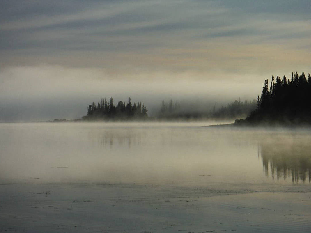
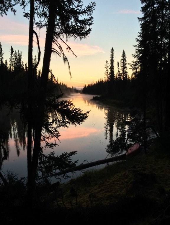
Sunrise on the Albany River.
Trip Report
Trip Dates: August 5 to August 24, 2016
Nearest City: Armstrong, Ontario
Put in: Rockcliff Lake, Ontario
Take out: Airport/Pikitiguish River Road
Water level: Low
Canoes: Spirit II by Wenonah (Royalex)
Paddlers: Hank Ostwald, Spencer, Iowa
Vern Fish, Waterloo, Iowa
Difficulty: Intermediate – This trip requires wilderness camping and expedition canoeing skills
Submitted by: Vern Fish, vernfish@aol.com
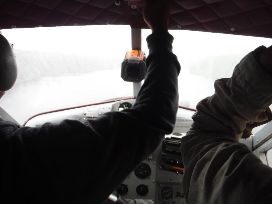
The view through the windshield of our plane just before landing on Rockcliff Lake.
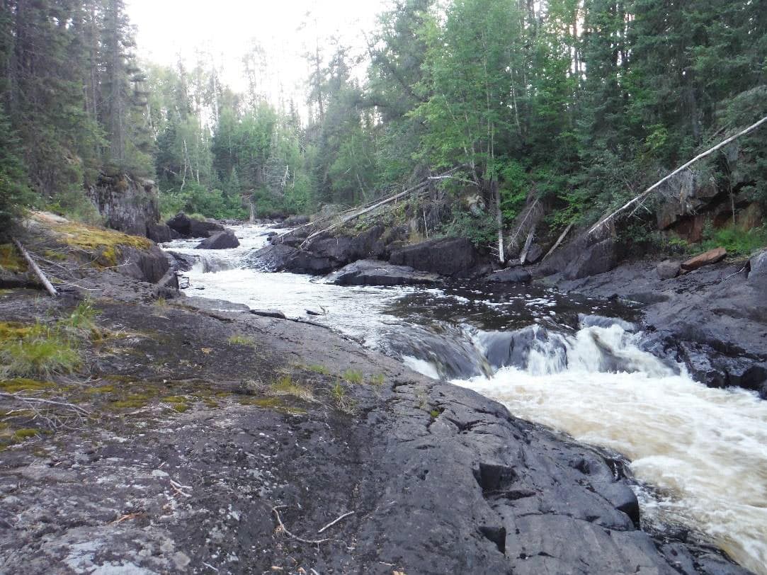
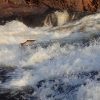
Looking up Iron Falls.
Wabakimi Project
In 2008 I had the opportunity to spend a week helping Phil Cotton clear portages on Crown Land on the west side of Wabakimi Provincial Park. Phil is the founder of the Wabakimi Project; it is his goal is find, clear and map the historic canoe routes in and around this huge wilderness area. This was my first exposure to paddling north of Quetico Provincial Park and I was hooked. I have been fortunate to be able to come back to that area Northwest Ontario also known as the “Little North” and paddle the Albany River, Winisk Rivers, Pipestone River, Gammon River, Bloodvein River and explore the crown land around Wabakimi. However, I have never actually pitched a tent in the park.
In conversation with Phil Cotton, he noted that one portage in particular needed to be explored and mapped. He was sure that there was a portage that connected the Misehkow River to the Greenmantle River because he had seen the access to the portage on a previous trip down the Misehkow. The Misehkow River joins the Albany River at the far northwest border of Wabakimi. In 2010 I was with a party that ran the Albany River and floated by the confluence with the Misehkow. I made a mental note that I should someday come back to run the Misehkow.
Thus, the idea of paddling from the northwest corner to the southeast corner of Wabakimi took shape. One of the goals would be to find, map and measure the portage between the Misehkow and Greenmantle Rivers as part of the Wabakimi Project. To accomplish this trek would require paddling down the Misehkow, Greenmantle, Attwood, Ogoki, Pikitigushi Rivers while paddling up the Shabuskwia, Witchwood and Raymond Rivers a distance of over 150 miles. Because we could not find a portage into the Greenmantle River, we actually paddled down to the Albany River and then up the Shabuskwia River to get back into the Attwood River. This small detour brought the trip distance to over 200 miles.
Maps & References
I started with the Wabakimi Canoe Routes Planning Map that has been put together by the Wabakimi Project www.wabakimi.org. This large scale 1:210,000 map provides an overall view of Wabakimi Provincial Park and the surrounding Conservation Reserves and Crown Land. The Wabakimi Project also provides more detailed maps which show routes, campsites and portages. For this trip we used the following volumes:
Ogoki River & Northern Tributaries – Volume 1
Albany River & Southern Tributaries (Chivelston Lake to Achapi Lake) – Volume 2
Albany River & Southern Tributaries (Patte Lake to Abazotikichuan Lake) – Volume 4
I also consulted the Wabakimi trip planning map provided by Ontario Parks. This 1:150,000 scale map is printed on a huge sheet of paper and it provides a summary of park rules, access points and other park details.
The Wabakimi Canoe Routes Planning Map also shows which 1:50,000 maps will be needed for a route. I ordered the following 1:50,000 maps from Map Town out of Calgary, Alberta at www.maptown.com:
Burnrock Lake 52 I 13 Greenmantle Lake 52 P 03 Pruner Lake 52 P 06
Grace Lake 52 P 07 Kilbarry Lake 52 P 02 Kawitos Lake 52 P 08
Slim Lake 52 P01 Whiteclay 52 I 15 Linklater Lake 52 I 10Pikitigushi Lake 52 I 07 Hurst Lake 52 P 08 Pringle Lake 52 P 07
Attwood Lake 52 P 02 Grinch/Witchwood 52 P 01 North Annette 52 I 10
In addition I ordered the following detailed maps from www.wabakimimaps.com:
Rockcliff Lake to Albany River
Attwood River to Whiteclay Lake and Pikitigushi River
These maps provided portage and campsite details for the Misehkow River, Whiteclay Lake, Raymond River, Witchwood River and the Pikitigushi River. The Wabakimi Project does not currently provide portage and campsite details for Raymond and Pikitigushi River. It was interesting to compare and see the differences between the two maps. They did not always agree on the location and distance of portages. Campsites were also inconsistent.
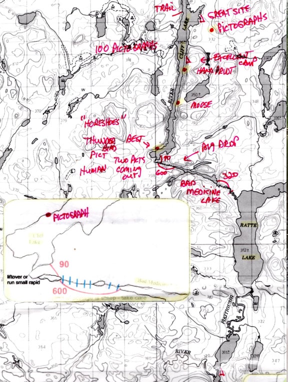
In some cases, I went directly to The Atlas of Canada – Toporama at http://atlas.nrcan.gc.ca/site/english/toporama/index.html and created more detailed small maps of critical portages or confusing points along the route. Finally, I “cut & pasted” the 1:50,000 maps to create (13) 14 x 17 inch maps that would fit in my map case. On to these maps I “cut & pasted” portage details from both the Wabakimi Project and Wabakimimaps.com. I also referenced a trip report by www.albinger.me/rockcliff-lake and added his helpful comments to the maps. The maps were copied and laminated. An example of one of these maps has been attached.
Permits & Fees
We bought our fishing license and the crown and park camping fees from Mattice Outfitters www.walleye.ca in Armstrong, Ontario.
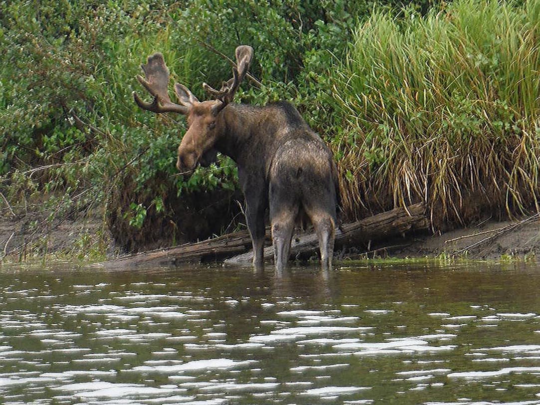
Bull moose near the confluence of the Misehkow and Albany Rivers
Logistics
I met Hank Ostwald in Clear Lake, Iowa and drove up I-35 to the Twin Cities where we stopped to rent a satellite phone from Globalstar Satellite Phone (richardhascall@comcast.net). We spent the first night at the Naniboujou Lodge along the Minnesota North Shore. The next day we drove up to Thunder Bay and met Phil Cotton at his house. We spent a fair amount to time discussing our trip and the status of the Wabakimi Project. Phil Cotton is a “reference library” on all things Wabakimi. He has paddle just about every corner of this huge wilderness area and he knows where to catch fish on every river! His love of this precious resource is evident as he recalls misty mornings, sandy beaches, thunderous waterfalls, wading moose and the pull of a brook trout.
We spent the night in a cabin at Mattice Outfitters just south of Armstrong, Ontario. Don and Annette Elliot run Mattice Outfitters www.mattice.walleye.ca. They provided the flight into Rockcliff Lake and the shuttle from our take out point on the Pikitigushi River, 40 km east of Armstrong. When I first visited Armstrong in 2008 there was a train depot, a couple of restaurants, a motel, school and a gas station. The train station is gone and the town is littered with abandoned houses. There is not much to see on what serves as a main street. The one bright spot was Gail’s Place which was a very good restaurant.
During the trip we paddled through North and South Annette Lake which are named after Annette Elliot. Don and Annette took a honey moon trip to these lakes and the name has stuck on Phil Cotton’s map. When I asked Annette about these lakes being named in her honor her answer was that it was, “Too long ago to remember”.
The next morning we unload our gear on the dock, played with Otis the resident German Shepard, and waited for the melodious rumble of a DeHavilland Beaver to appear over Mattice Lake. The plane landed and Dave, the pilot, loaded us and the gear into his red plane. He tied the Iowa Rose my well-traveled, scarred, red, royalex canoe on to the pontoon for the 45 minute flight across Wabakimi to Rockcliff Lake.
Trip Overview
This trip can be broken to three watersheds and eight different rivers. Because we crossed so many different watersheds we actually paddled through four different parks and reserves in addition to crossing crown land. These parks included Wabakimi Provincial Park, Albany River Provincial Park, Attwood River Conservation Reserve and the Whitesand Provincial Park. We paddled up three rivers which required lining, dragging and portaging upstream. Paddling up stream is a necessary evil to explore the Wabakimi region because it straddles so many watersheds.
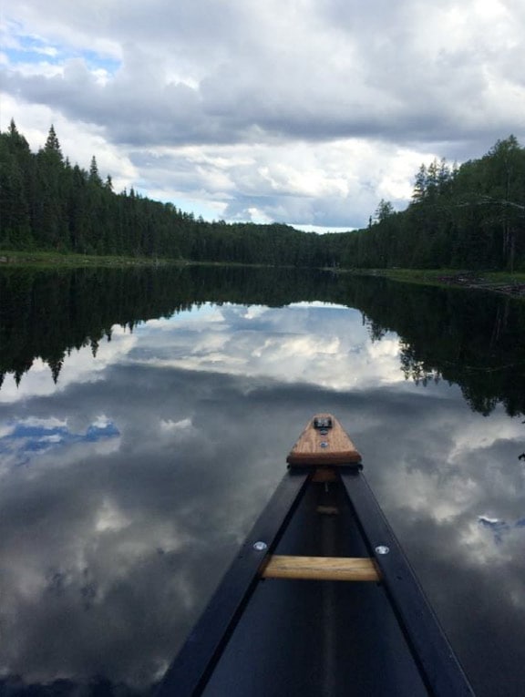
We started in the Albany watershed and paddled our way in and out of the Ogoki watershed to finish in the Lake Superior watershed. During the course of the trip we paddled down the majority of the Misehkow River and a beautiful short segment of the Albany River. At Patte Lake we turned south and paddled, lined, portaged and dragged the entire length of the Shabuskwia River to get into the Attwood River! We experienced a segment of the Attwood River Conservation Reserve before going up the entire length of the Witchwood River. We climbed the height of land and began a brief tour of the Ogoki River. We paddled down the Ogoki River, through the Ogoki Gorge, and then sailed across Whiteclay Lake to the mouth of the Raymond River. We put the sail away and paddled up the Raymond River to the final height of land where we crossed into the Pikitigushi River. We followed the Pikitigushi River which is part of the Whitesand Provincial Park for the downstream run to the road and the 40 km drive back to Armstrong.
Highlights & Observations
Trip highlights included waking up to the roar of Iron Falls and watching the mist lift in the early morning light. Floating a beautiful segment of the Albany River on bright sunny day for the second time in my life! Paddling and dragging a canoe up the charming, clear Shabuskwia River. (This little river is a gorgeous whitewater treasure and I can only hope I get to do a downstream run someday!) Listening to an osprey warning chirp while picking blueberries on the Attwood River portage. Running a tricky little rapids into Hurst Lake and paddling against the pull of Witchwood River for two days to find a lovely little waterfall at the source. Bouncing echoes off the cliffs in the Ogoki Gorge and finding hundreds of pictographs on the massive walls of Cliff Lake. Listening to the rumble of the Bad Medicine Gorge and exploring an abandoned plane on Wash Lake. Finally, crossing the Gooseneck Portage and leisurely floating the Pikitgushi River while eagles soared above on the last day. The float down the Pikitgushi justified all of planning, portaging and paddling.
The low points included: our inability to find a portage into the Greenmantle River, the hours we spent dragging our canoe through a bog south of Pine Bay on Shabuskwia Lake and the hundreds of “log step overs” we endured to get into Attwood Lake. The portages coming up the Raymond River and down the Pikitgushi River which were physically demanding.
Finding and meeting people along the way was heartwarming. Yes, we planned this trip to experience wilderness and yes, we did experience total isolation for the majority of the trip. However, every time we dropped back into civilization we were rewarded with the best of human behavior. Everyone we met greeted us with open arms and went out of their way to make us feel welcome. They invited us into their space and fatten us up with food and drink (Pepsi, Coke & beer). They shared their stories and listened to our adventures. At times I felt like a visitor from outer space who had just crashed landed on earth. Our hosts could not image why we would want to cross this harsh landscape with nothing but a paddle! I could not imagine being trapped on just one lake in a motor boat. Either way, we all enjoyed our adventure in the Wabakimi wilderness!
Wabakimi is dotted with outpost cabins that cater to the fly-in fishing adventure. We did not see an outpost cabin until day 8 but they became a regular feature for the last 12 days of the trip. To the wilderness advocate, these cabins interrupt the wilderness experience. As noted, we enjoyed our rendezvous with the residents of these cabins. We did camp on the open space around these cabins. Sometimes, these outpost cabins were the only place to camp. The cabins are reference points on the map and the portages between lakes with cabins are often cleared to provide access to cached boats on the next lake. In an emergency, an outpost cabin could be the difference between life and death.
A true wilderness would not have portages and campsites that had been cleared, marked or mapped. I totally enjoyed the first week of our trip because it was isolated, wild and there were informational gaps on our maps. However, there are only a few hundred paddlers that explore Wabakimi Provincial Park each year. I would guess that there are thousands of fly-in anglers who support the local economy. I have to admit, that more than once, I was overjoyed to see a cabin as we rounded a point at the edge of darkness. Wabakimi provides many opportunities for wilderness travel while still offering an opportunity for the less adventuresome to experience a wild area. Outpost cabins do have their place in Wabakimi Provincial Park.
Trip Log
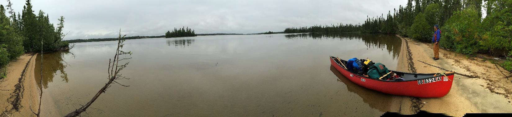
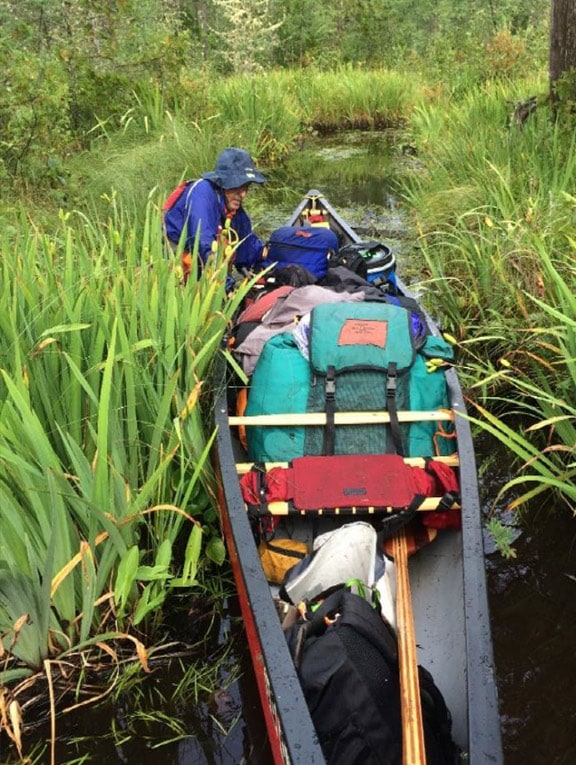
Misehkow – Albany – We tried to land on Rockcliff Lake just as a front swept across northern Wabakimi. The squall line hit just as we banked to line up for a landing. The windshield filled with rain, visibility dropped to zero and our little plane started bucking like a bull at the rodeo. My seat belt kept me from hitting the ceiling, but it left my breakfast hanging in midair several times. The pilot asked where I wanted to land and I tell him at the old outpost cabin on the west shore so we can unload and organize our gear before paddling north into the Misehkow River. He did a couple more loop to loops and finally dropped through the rain and put the plane down on the narrow lake. He could not get to the outpost cabin so we unloaded while floating on the lake in the rain. The pilot said “good luck” and off he went.Day 1 – We took stock of where we were and what is in the canoe. It looked like everything survived the landing so we paddled north into the first swift and out of the lake. We saw our first cow moose and found our first portage around a small waterfall. The water level seemed to be low as we bump our way down several more swifts to find a campsite between Lowry Creek and August Creek.
Day 2 – One highlight of the trip was Iron Falls. We ran a narrow CI and enjoyed a long wave trail to get to the 700 meter portage around the falls. The campsite was about halfway down the portage and it provided a great view of this little falls. At low water, Iron Falls is more of a cascade than a major drop, but it still makes plenty of noise! I could not hear my stove over the roar. Phil Cotton said this would be a great place to catch Brook Trout but all I could do was lose lures and watch Hank catch really small walleyes. If I ever make it back to the Misehkow River, I would spend an extra day at Iron Falls and bring more lures.
Day 3 – We explored Miner’s Camp which appeared to be a semi-abandoned exploratory research camp downstream from Iron Falls. The cabins were filled with stoves, equipment, pots, pans, clothing and maps. There were several small, low sheds filled with ore samples. The maps on the tables showed a detailed search grid to the north of the Misehkow River. I have always wondered why the Misehkow River, which is halfway between the Albany River Provincial Park and Wabakimi Provincial Park, was not within either park boundary. I can only hope that the ore samples do not reveal a valuable mineral and that the Misehkow will someday become a part Wabakimi Provincial Park.
We sailed and paddled our way past Mooseview, our next campsite. Ramblin Boy (www.albinger.me/rockcliff-lake) in his 2013 report named this site because he watched moose crossing the river downstream from the campsite on a small bluff. There are very few places to camp, or even stop for lunch, along the Misehkow River due to the low mud banks. Mooseveiw is on a low bluff at a turn in the river. I missed it because I did not look over my shoulder as we floated by. A couple kilometers further we recognized our mistake and paddled upstream until we saw the old fire ring on the bluff. It was much easier to see this great campsite going upstream!
Hank Ostwald pulling the canoe up the Shabuskwia River.
Day 4 – The entrance to the Greenmantle Portage is about 8 miles downstream from Mooseview. It is marked with a couple of old blazes on the trees but there was no obvious portage trail heading east. We walked into the small lake, that is halfway between the two rivers, and did a crisscross search pattern but we could not find any blazes or a hint of an established trail. After three hours we gave up the idea of finding a trail. I thought about bushwhacking the canoe over to the Greenmantle but that would have been both exhausting and dangerous. We were now committed to paddling down to the Albany River and up the Shabuskwia River to get to Shabuskwia Lake.
Day 5 – The next day we saw our only bull moose just upstream from the confluence with the Albany River. From my 2010 trip on the Albany, I remembered a good sized whitewater drop just downstream from Misehkow. I was not disappointed with strength and width of this whitewater. The Albany is a much bigger river then the Misehkow and its whitewater is more impressive than the drops on the diminutive Misehkow. That night, a family of otters visited our camp.
Day 6 – I had fond memories of this stretch of the Albany and I was not disappointed with my second trip. We were pulled downstream by the powerful current under a bright sunny sky. The upper Albany provides a challenging series of whitewater drops separated by waterfalls, lakes, long stretches of hard running water and braided channels. I remembered exploring two separate “mazes” or braided channels in 2010 on this stretch. We had just as much fun working our way through these labyrinths to get to Patte Lake as I did six years ago.
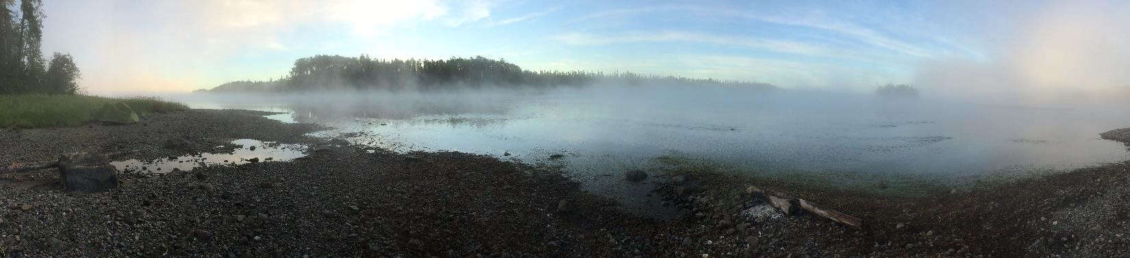
Morning mist on Patte Lake.
Patte Lake is a shallow wetland that has been created at the confluence of the Shabuskwia and the Albany Rivers. Phil Cotton had told us, with a twinkle in his eye, that we would enjoy this campsite. It had a beautiful sand beach with a homemade picnic table that was slowly being shallowed by the Bush. We watched osprey diving for fish and were blessed with a beautiful sunset and misty sunrise. The water is always cool, but the sand beach was a great place to bathe, wash clothes and soak up the sun.
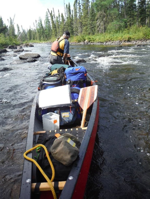
Day 7 – Floating downstream became a distant memory as we began our ascent up the Shabuskwia. Phil said it as beautiful little river and great float. However, we were now going upstream. It was a gorgeous, clear water, brook trout stream with several wonderful Class I drops that we lined and dragged up. More than once I looked downstream and imagined the run back to Patte Lake! We finally reached a bend in the river just downstream from the confluence of the Greenmantle and the Shabuskwia. If we could find the portage, we would be able to by-pass a long series of drops and avoid more upstream lining.
We landed in the right place. After a while, I found a saw cut and tree blaze which indicated that someone had been there before us. The map showed a campsite at the start of the portage but it had long since been reclaimed by the forest. The trail was marked with tree blazes and crisscrossed with blowdown and leaning trees. We may have been the first paddlers to cross this portage since it was last cleared. We walked and marked the route with survey tape to the far side and cut and cleared our way back to the canoe.
After we got all the gear across, Hank wanted to walk down to the confluence of the Greenmantle and Shabuskwia just to say that we saw the Greenmantle. According to the map, there should have been portage trail, but the boreal forest had long since covered it. We walked parallel to a rapid and finally came out on a well-used campsite. The fire ring was filled with charcoal and there was room for several tents. Later I asked Don Elliot who was using this campsite. His answer was that people flew into Suzanne Lake and paddled down the Greenmantle or came down the Shabuskwia River from Shabuskwia Lake and continued down to Patte Lake. Either way, this campsite was not on our maps. We paddled a short way up the Shabuskwia River and found a campsite that was on the map.
Pulling the canoe up Shabuskwia Creek.
Day 8 – We crossed the river and cleared another portage trail to avoid a small rapids. We dragged our canoe up several more Class I rapids until we reached Pucill Lake, a shallow wetland. The inlet from Shabuskwia Lake to Pucill Lake was amazingly hard to find, but we finally paddled into the big lake and over to an abandoned outpost camp. After a week or so in the backcounty, it was strange to see a dock with heavy wooden deck chairs. The cabin was a pile of rubble but the outhouse was still serviceable, according to Hank.
A motor boat pulled over to see what we were doing. They were staying at an outpost cabin further down the lake and were curious as to who we were and where we came from. They were moose hunting guides and they were clearing trails into their moose blinds for the hunt that fall. After, week in complete isolation, it was strange to meet and talk to other human beings!
Day 9 – It was raining at daybreak, so we did not get on the water until 11:00 AM. The moose guides had invited us down for a can of Coke so we paddled south on Shabuskwia Lake in a light rain to Shab Island Outpost, their outpost cabin. They were packed and ready to fly out to avoid the in-coming storm, but they opened up a tub of moose stew and fed us lunch. The Coke had already been flown out so I washed down my moose with gator-aid. Their plane landed, loaded up and disappeared into the approaching rain. We were alone again.
We spent the rest of day looking for a campsite on the south end of Shabuskwia Lake in Linsey Bay without luck. The maps showed four different sites, and but our inspection tour failed to locate a single opening that had not been covered by fresh growth or downed trees. It was getting late and raining when we found a slab of rock jutting into the lake that looked promising on east side of the entrance to Pine Bay. I cleared some brush to create an opening for my tent. We were able to pitch the rainfly and Hank’s tent on what was left of the rock. This was not last time we would need to carve an opening in the boreal forest to get off the water. I left a pile of rocks, on the slab, to help the next paddlers find our boreal nook.
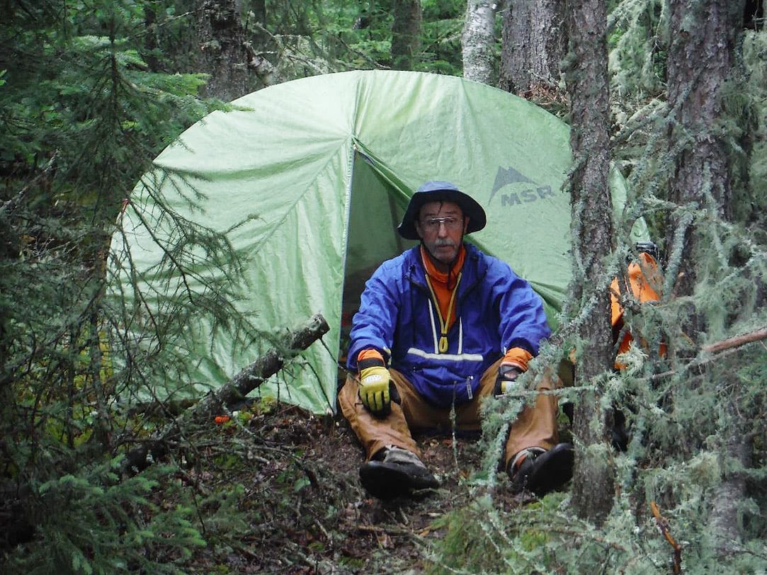
Vern Fish tucked away in the Boreal Nook campsite on Pine Bay at the south end of Shabuskwia Lake.
Day 10 – To cross from the Shabuskwia watershed into the Attwood River required a 1000+ meter portage up and over a series of beaver dams before crossing into two small lakes. Because the water level was so low, it took over three hours of paddling, pulling, pushing, dragging, lifting, tilting, cutting and a short portage over a soggy bog to reach the first little lake. This may have been the worst three hours of “paddling” I have experienced in the “Little North”.
The next two portages had been flagged and cleared and we were happy to finally reach Musgrave Lake. We dropped the canoe into very shallow water and tried to push off only to be surprised again. I am a farm boy and I have shoveled my share of animal waste. The boot sucking muck at the west end of Musgrave Lake had the color and consistently of aged hog manure. It took over 20 minutes to ladle our way out to open water. We were very happy to find the outpost cabin on Musgrave Lake and call it a day.
Attwood River – The head waters of the Attwood River flow into Musgrave Lake and continue on to the Albany River. We followed this drainage until we reached the Witchwood River, a tributary of the Attwood.
Day 11 – The portage out of Musgrave Lake was the best maintained trail we had seen so far. We found a fishing boat that was filled with water cached on the Kilderry side. The wind was out of the west and we used the sail to pull us across Kilderry Lake to the next series of portages. The first portage was 255 meters along the river’s edge through thick vegetation. It appeared that trail had been recently cleared. As we lined and paddled to avoid the next three little portages we “surprised” our second cow moose standing in the middle of the river. She was in no hurry to get out of way and let us pass. The last drop required us to pull the saws and clear a path through a tangle of down trees so we could line the canoe into Portage Lake, a good sized shallow wetland.
Portage Lake was filled with bulrushes with no clear path to the outlet on the northeast corner. We plowed through a wall of green trying to find open water or a path. The bulrushes felt like a thousand little hands trying to grab the canoe. To keep from getting lost in the thick vegetation, I remember standing up a couple of times to find a reference point on the distant shore, bottom of Lund boat. We pulled, poled and pushed the canoe toward the cached boat on the distant shore that marked the entrance to the portage. The campsite, which was open rock across the river from the portage, was partially covered with downed trees. We used the saws to clear openings for the tents. All and all, it was a fun day and we got to see and do a lot of different things!
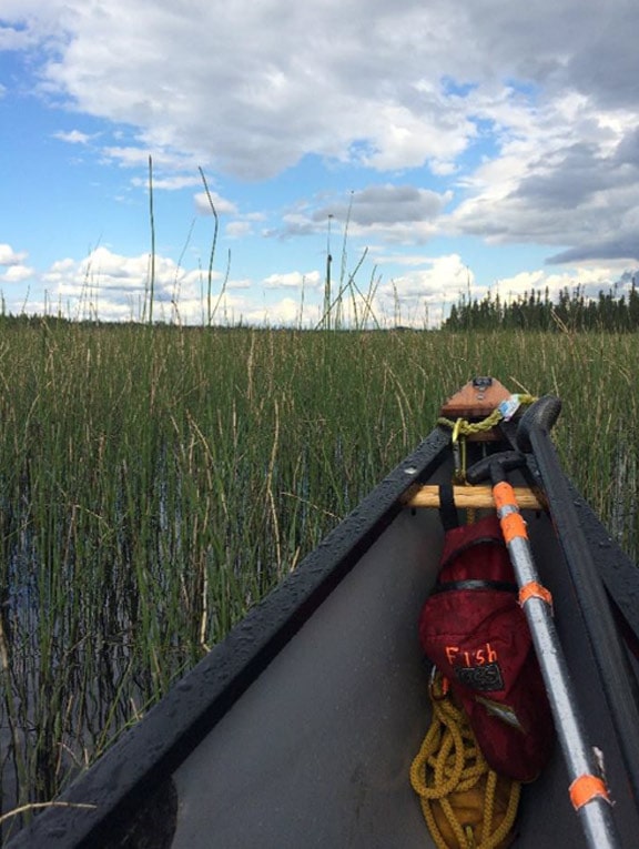
Pushing through the bulrush on Portage Lake.
Day 12 – It was cloudy and drizzling as we started the short paddle to cross the river. Suddenly, all “hell broke” loose as we were pelted with driving rain and surrounded by lightning flashes and the boom of thunder. I was never so happy to get off the water and on to a portage trail! The well-marked 700 meter trail took us to Luelle Lake which we crossed to get to the start of the 1500 meter Attwood River portage.
This portage was almost one mile, one way, so we hoped for a well maintained trail. We hit our first tangle of downed trees within the first 200 meters. It only got worse as we leap-frogged our way across the portage. At one point, Hank counted over 200 ‘step-over” logs on just one segment of trail. We took turns cutting, clearing and portaging our way through the woods until we came out in a recently burned area where the trail faded in and out. We piled our gear and the canoe on the bluff overlooking the put-in and dug into the lunch barrel for a late lunch after three hours of portaging. In hindsight, it might have been easier to run and line the river instead of portaging!
The next 3-5 km was a pleasant float down the Attwood River. It had a couple of nice swifts at the top end as a small reward for all of the work on the portage. When we came out on Attwood Lake, we saw a motor boat at a distance. It veered off and disappeared. Attwood Lake is big and it was getting late so we headed out for the nearest campsite on a distance island. We could not find the campsite and started looking for the outpost cabin on the next island. Fatigue and darkness were creeping up on us as we kept looking for the cabin around each point. Finally, we started to hear voices as the cabin came into view.
I am guessing we looked pretty rough and a little sad, so the fisherman from Northern Michigan welcomed us to their cabin for a supper of beans, potatoes, walleye and bread. The meal was followed with pie and cookies which were washed down with milk and beer. Mixing milk and beer was a bad idea. Both came back up a couple times during the night. The next morning, they feed us breakfast left overs and gave us a couple of beers to go. A great bunch of guys!
Day 13 – In the morning the outpost cabin island was completely surrounded by a wall of fog. All we could see was a bright glob in the eastern sky that represented the rising sun. I knew that we needed to go northeast so I aimed the boat to the left of the yellow glob and off we went. Every now and then Hank would pull out his GPS device and we would confirm our location. Between dead reckoning and modern technology we worked our way across Attwood Lake until the fog lifted.
We looked for the second outpost cabin on Attwood Lake. At the Mattice dock we had met a family from New Jersey who was headed for Attwood Lake. They had invited us to stop in. For several days we had been fantasizing about getting a can of Coke from this family. We missed the second cabin, but we met the guys who were using it out on the water. They were not from New Jersey and they did not offer us a can of Coke. After a brief conversation, we headed for Hurst Lake rapids.
The drop from Attwood Lake into Hurst Lake was a nice little CII tech. At high water, this would have been a series of drops but at low water two ledges cut off the flow and pushed the water to the far left. Neither one of us wanted to portage after the three hour hike yesterday, so we got out and scouted the run. The line started with two nice little drops on the right and ended on a ledge that pushed the water hard to the left and behind a big rock. We could not see the drop behind the rock, so we ran the left side and lined our way down to just above the rock. We hooked around the left side of rock, dropped through a little chute and ran the wave train down to an eddy on river right above the next ledge. Hank eyeballed the run and told me to do an upstream cross ferry to the left, hook hard right and hit the drop on the far left side of the ledge. We left a little red Royalex on the last rock, but it turn out to be the best rapid of the trip.
We paddled into Hurst Lake and found the outpost cabin. These guys who were staying in this cabin were from Indiana and they feed us diet Coke, chips, cookies and a bratwurst. They even gave us a diet Coke to go. We had a great time talking and sharing stories before we pushed off and headed for the mouth of the Witchwood River at Felsia Lake. We pushed upstream against the flow and into Felsia Lake and found the next outpost cabin. We washed down our supper with diet Coke from Indiana and a beer from Michigan, “life is good”.
The Felsia cabin was decorated with drift wood, paddles and plywood scraps that immortalized the fishing achievements of previous guests. My favorite was a quote from Emerson:
Live in the sunshine
Swim in the sea
Drink in the wild air
The next day we started our two day paddle up the length of the Witchwood River!
Day 14 – We got on the water at 9 AM and made good time crossing Felsia Lake to begin the climb up the Witchwood River. We lined and walked up several whitewater features and swifts and only portaged twice. We added our red markings to the blue scrapes the previous paddlers had left on the rocks. An outboard motor and several beer cans marked one of the portages. We found almost no garbage on our trek, so this outboard motor was a true oddity. How it got here and why anyone would want to portage it up or down the Witchwood River will always be a mystery. After another hard day we found a great campsite just before Grinch Lake.
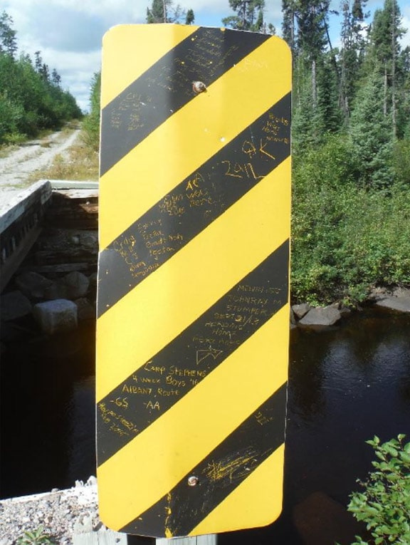
Trip reports on Ogoki Logging Road Bridge Sign.
Day 15 – The Witchwood River narrowed and became rock filled, log jammed creek just before it dumped into Grinch Lake. The 1300 meter Ogoki Logging Road Portage bypassed this river segment. It would become our next major hurdle to endure. Anytime a portage has a formal name, you know you are in for a hike. The paddle across Grinch Lake and up the creek was just a warm up for the work ahead.
Once we figured out which way the portage trail went, we hauled a load to the logging road bridge which bisects the portage. The logging road is very near the end of the portage, so you get a false since of completion when you stagger up the road shoulder and find a bridge. We pulled the saws and want back to clear the down logs and low hanging branches so we could bring the canoe over. It took time to clear a trail and we still had trouble getting the canoe through the trees. Hank said he felt like a pinball in an arcade as he squeezed between branches and bounced off trees.
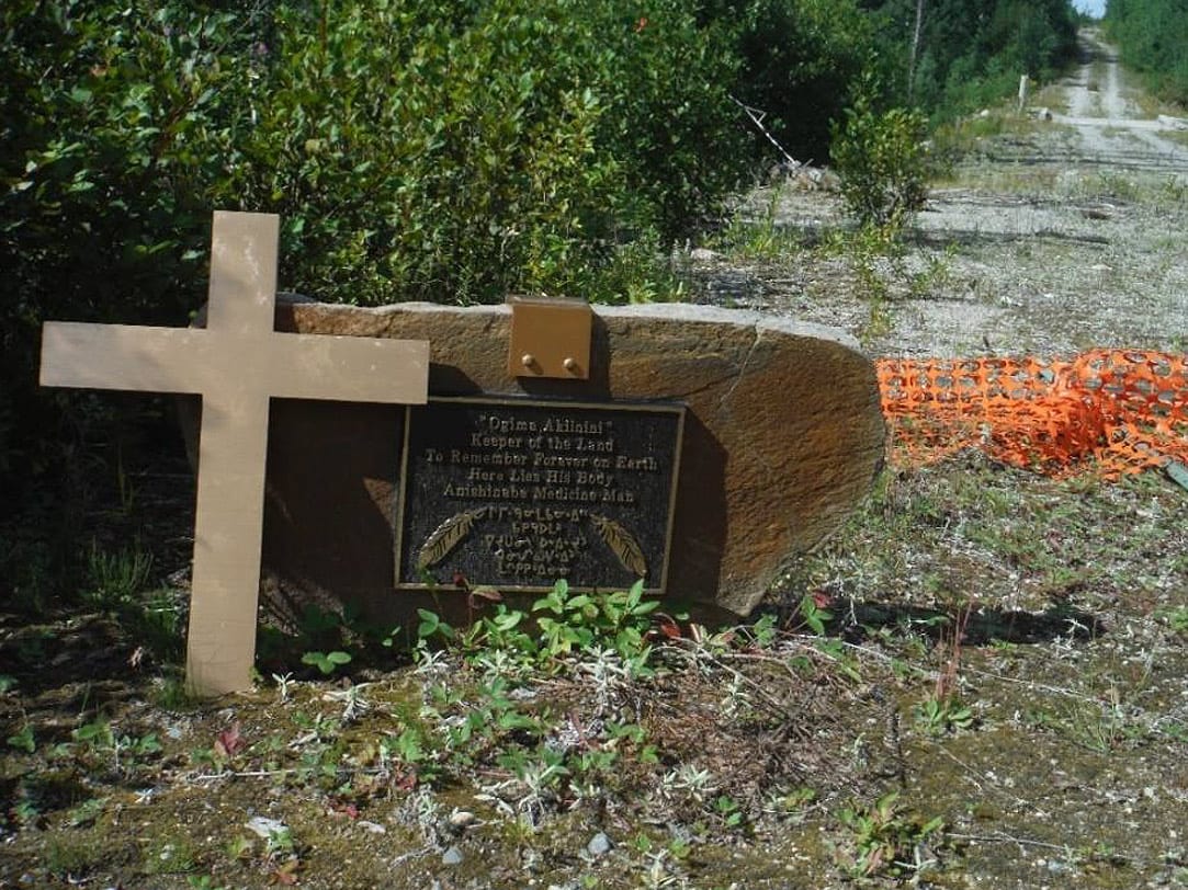
Ogima Akinini tombstone on logging road portage.
We had a late lunch on the road in the afternoon heat. I wander up the road to a gravestone that had been placed on the south shoulder of the road, east of bridge.
“Ogima Akiinini”
Keeper of the Land
To Remember Forever on Earth
Here Lies His Body
Anishinabe Medicine Man
It is my understanding that Ogima Akiinini lived in Fort Hope which is village on the Albany River a few days paddle to the north. I had spent a couple of days in Fort Hope so I kind of felt a connection to this individual. I have yet to find any history or details on why this individual was buried at this location, but I plan to continue my research.
Hank found a bridge warning sign which had become a trail marker for previous groups:
Camp Stephens Melvin SJ AC
4 week Boys “16” JohnRay M Elan was here
Albany Route Stumper W 2016
GS AA Sept 21/13
Aug 2016 Heading Home
Fort Hope
It appears that at least two groups had passed this point within the last few weeks. Several other groups had crossed this portage in the last few years.
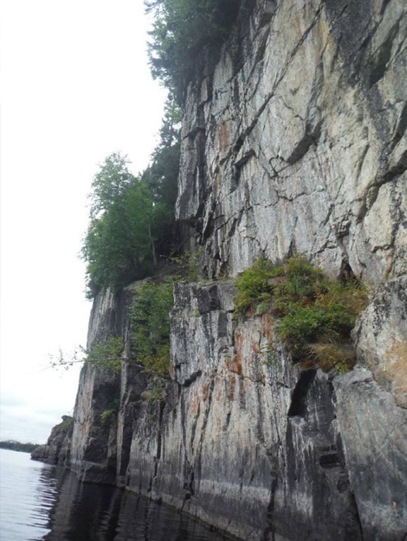
Ogoki Gorge Cliff.
We completed the portage and resumed our paddle up the Witchwood River which was fairly narrow for a few kms. Twice, Hank had to get out and cut logs with his “big ass” saw, to unblock the river before we reached Witchwood Lake. The lake is a long narrow channel surrounded by stunning cliffs. At one point we had to portage/lift over a sizeable beaver dam which bridged the cliff walls. The sun was low and the water was glass smooth as we reached the upper end of the lake. A small waterfall marked the headwaters of the Witchwood River and the beginning of our height of land portage.
The trail went straight up the hill for the majority of the portage. The trail was in good shape and did not require a lot of saw work. However, this was the most vertical climb we had faced on this trip. We got the gear over and decided to set up camp before it got dark. We would bring the canoe over the next morning. I was able to set up my tent on a sand beach on the Whiteclay Lake side of the portage. I only wish we could have gotten here sooner to enjoy the beach!
Clouds on Upper Witchwood Lake.
Day 16 – I went back down the hill to retrieve the canoe, but my efforts were interrupted. I had to pause a few moments and soak in the view of the narrow channel reflected on still water in the early morning light. The view was enhanced by the murmuring of the little waterfall that marked the beginning of the Witchwood River.
Hank took a look at the map and directed the canoe down a narrow channel that went down the east side of an island in the Ogoki River because he liked the look of the steep topography. Great choice, we were greeted by a spectacular line of cliffs on both sides. He parked the canoe under an overhanging rock formation to get some photos. We were surprised to hear our voices bounce off the vertical wall to our left. For a few minutes we talked to the rocks and they responded. This channel does not have a name on the map, but I am calling it the Ogoki Gorge.
Our day only got better when we entered Whiteclay Lake and picked up a tail wind. The sail came out and we surfed to the bottom of the lake. We found the next outpost camp and took a hike. Nobody was home so we pushed on to the mouth of the Raymond River and began our assent. We were stopped by Raymond Falls which due to low water flow had been reduced to cascade. Access to the portage had been pushed out into the channel due to the low water level. We wedged the canoe up on the rocks and hopped from rock to rock to get to the shore line. The 300 meter portage had been recently cleared and was in good shape. We found a small campsite at the end of portage and set up for the night.
Raymond River at sunrise.
Day 17 – The temperature dropped during the night and I had to dig into the bag to find a stocking cap. We got on the water by 9:15 and continued our paddle up the Raymond River to Pickett Lake. There was no noticeable current so the paddle was both enjoyable and scenic. The Pickett outpost cabin was well maintained and looked like a great place to spend a week. We crossed Pickett Lake and paddled up stream to the next portage which was listed a 1000 meters.
We choose to line up a couple of drops to shorten the portage until we were stopped by low water. To get back to the main portage we had to take a side trail. The side trail was not that long but it was a nightmare. It was filled with down logs and overgrown with alders and hanging branches. In addition, it was hard see if we found the portage that would take us south to the Pikitigushi River or if we wandered onto the cross portage that would go west and continue going up the Raymond River. After a few minutes of head scratching and staring at the compass and the GPS, we concluded that we were at the right landing and still going in the correct direction. In hindsight, it would have been easier to take the 1000 meter portage which we discovered had been recently cleared.
A short paddle across the next little pond put us on a wonderful 300 meter portage. I say “wonderful” because it had been recently cleared and it was a pleasure to cross. The contrast with the previous portage was like night and day. We entered North Annette Lake and continued south. At high water, we might have been able to lift over or line the two short portages that separate North Annette from South Annette. We were forced to unload and do two short carries. The map indicated a “great campsite” on South Annette which we had trouble finding. We found a less then suitable site and camped. The next morning we found the “great” site a little further down the lake on a different point of land.
Looking down the Misehkow River from Mooseview campsite at sunset.
Day 18 – To enter the Pikitigushi River watershed, we had to cross our last height-of-land portage. The first leg was 570 meters and it ended at a small pond. To reach the landing on the lake, we had to cross a bog. It was low and wet; it would have been easy to take the wrong turn. The landing was actually a hanging bog that felt like a soft trampoline when I jumped. A short paddle across the small lake landed us on another hanging bog to start the 680 meter portage into Butland Lake. It took about 3 hours to get into Butland Lake.
We stopped at the Butland Lake outpost cabin for lunch. This cabin was not in good shape and was filled with mouse droppings, a Hanna Virus Retreat! It was a cool sunny day, we each found a place in the sun and took a short nap before we tackled the 1370 meter portage into Cliff Lake. It may have been the best nap on the trip! The portage looked imposing on the map but the trail was in good shape and it actually was a good walk.
Cliff Lake was impressive! It was surrounded by big vertical walls of solid rock and it offered two great campsites on the east side. We paddled past the second campsite on the east side of the lake and found the first pictograph panel. This one had faded badly and was not very clear. There was supposed to be a hand print but I could not find or see it.
We paddled back and climbed up to the campsite. This campsite had a great view of the lake. We built a fire and enjoyed the scene from our perch on the cliff. I found this lake to be magical and powerful. I think I can understand why native people would spend days portaging and paddling to get into this lake to tell their story on the rock.
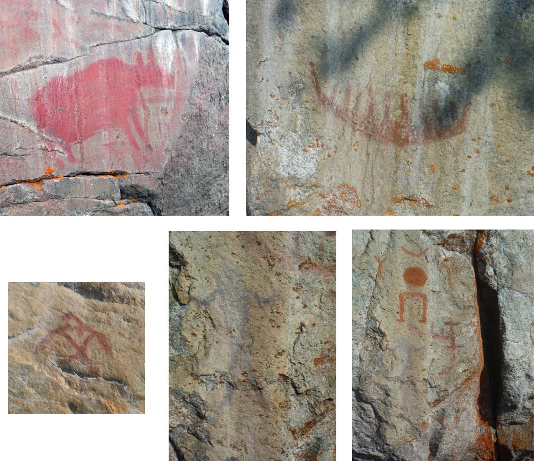
C liff Lake Pictographs- (Upper left) Moose on east shore. (Upper right) Canoe on southwest shore. (Middle left) Thunder Bird on southwest shore. (Middle Right) “Legs walking by themselves”, faint canoe and dark shaman with arms raised on southwest shore. (Bottom left) Close up of dark shaman on southwest shore.
Day 19 – When the morning fog lifted, we had a panoramic view of the massive cliff on the west side of the lake in the early light. I could only hope that my digital camera captured the image that came through my eyes and lodged in my memory. I was torn between watching the sunlight dance across the cliff or pressing on to explore the pictographs on the south end of the lake. I may never see another sunrise on Cliff Lake. I did spend a memorable morning paddling the shore line looking for moose, thunderbirds, red canoes filled with paddlers and shamans lifting their arms to the sky. I have attached a few of these images to this report. Selwyn Dewdney, who visited this site in 1965 and 1966 and documented these images, noted that Cliff Lake is
“a concentration of petrographs that is exceeded only by the Hickson-Maribelli sites north of the Churchill River in Saskatchewan and by the Bon Echo sites on Lake Mazinaw in southeast Ontario.”
I have been fortunate to visit several pictograph sites in the BWCA, Quetico, Woodland Caribou Provincial Park and Atikaki Provincial Park that are more impressive and better preserved than the Cliff Lake panels. I was not disappointed by what I was able to see. I was discouraged by my inability to see and interpret many of the panels. Selwyn Dewdney lamented that over half of the Cliff Lake pictographs were indecipherable. Cliff Lake is blessed with a huge number of images which have faded and require careful observation and patience to appreciate them. The ones that have not faded are very impressive and memorable.
The 90 meter portage out of Cliff Lake dropped us into another “unload” lake. You load the canoe, paddle a few meters, unload and start portaging again. In this case, the next portage was a 600 meter drop down a gorge into Bad Medicine Lake. The trail was a steep climb in places and the landing was a sharp drop into the lake. The gorge was wide, steep and loud. It was an imposing and impressive portage. Bad Medicine Lake was guarded by steep walls and was a smaller version of the Cliff Lake. I kept thinking that someone or something could be watching as we paddled through it.
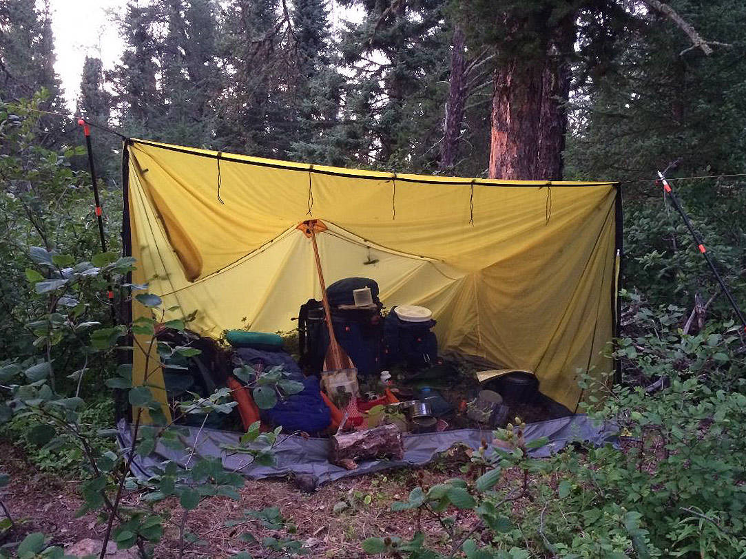
Our Cooke Tundra Tarp (Bug Tent) pitched at the Raymond Falls campsite..
The next portage was an easy 320 meter hike because it had been cleared. We were now in Ratte Lake and on the Pikitgushi River. We worked our way down Ratte Lake and into Gort Lake. We stopped about half way down Gort Lake and used our satellite phone to call Mattice Outfitters to let them know we would be at the road sometime the next day. To get into Wash Lake, we bounced our way down a cascade of rocks. I hesitate to call it a rapid because the water level was so low. We found the abandoned airplane at the southwest corner of Wash Lake and spent some time crawling around it. The motors had been stripped out and it was covered with “I was here” graffiti.
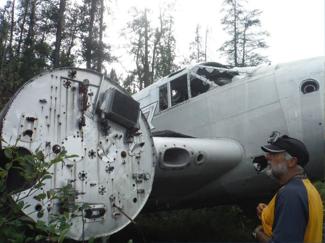
Abandoned plane on Wash Lake.
We bounced down another cascade of rocks to get into Derraugh Lake and started looking for last campsite of the trip. We passed a couple of small well-kept private cabins as we worked our way into Derraugh Lake.
We finally found a good spot on the west shore on a point overlooking the big bay on west end of the lake. This site was not on our maps. That night, a front rolled over the lake and we were serenaded with the roar of powerful wind gusts, the boom of thunder, the flash of lighting and occasional pounding rain.
Day 20 – It was still gray and overcast when we broke camp and started our run to the road. We found a weak CI rapid at the end of Derraugh Lake and assumed that this was the start of the Gooseneck Rapids and the beginning of our last portage which was 1465 meters. We spent over 45 minute trying to find the landing to the portage with no success. After staring at the map and scratching our heads for several minutes, we decided to run the rapids and look for the portage further down the river. We found the landing on river right. It was well marked with survey flags and a door off the abandoned plane on Wash Lake!
Hank picked up the canoe and proceeded to carry it across the entire portage with no stops! The trail had been recently cleared and was in great shape. With the wind in our face, we crossed Pikitigushi Lake and entered Pikitigushi River. We floated and paddled while watching eagles wheeling above us. I guess we were in no hurry for the adventure to end! We arrived at the Bear Camp which marked the end of our trip. We walked into the nearest tent just in time to watch a bear being skinned. While we watched, our ride arrived and we loaded our gear as it began to rain hard. It rained even harder has we bounced our way down the 40 km of poorly maintained logging road to Armstrong and Mattice Outfitters.
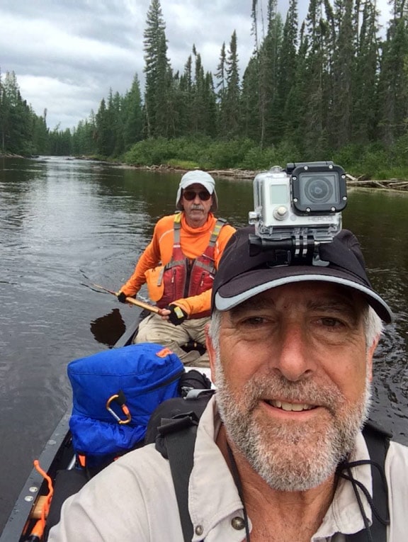
Vern Fish and Hank Ostwald somewhere on the Misehkow River.


Awesome trip report, Vern. Keep your paddle wet and your hair dry.
Hi Vern
Nice Trip! I have done 3 solo trips to wabakimi .I have gone out with Phil god rest his soul. Always looking for people to hit the bush with. Being from the south side of Chicago its hard to find the right minded people. Ever need another guy for a trip to any where ?