

Pipestone/Winisk River Trip Report
-
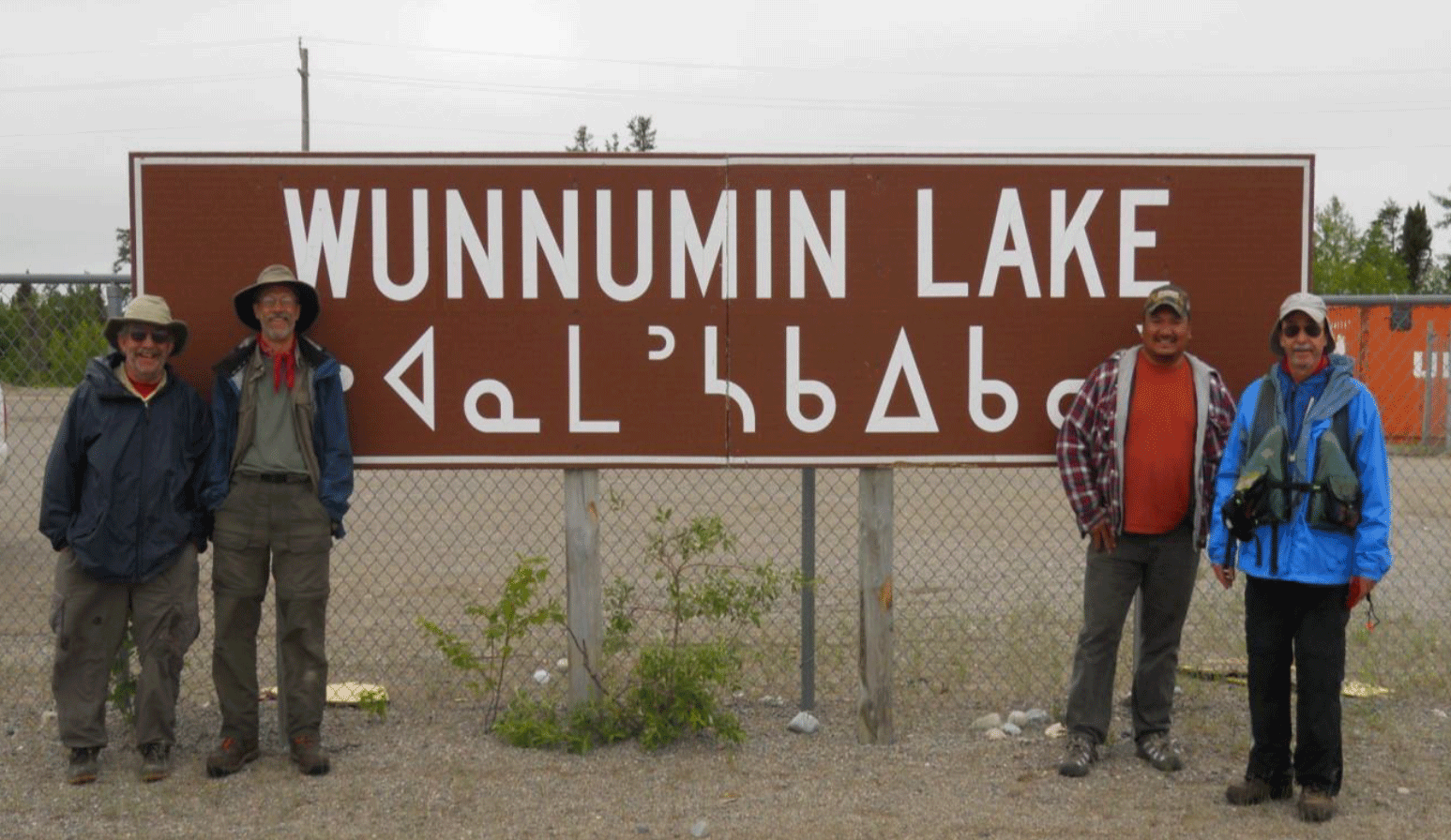
Jerry, Kevin, Ralph and Vern at the Wunnumin Lake Airport.
-
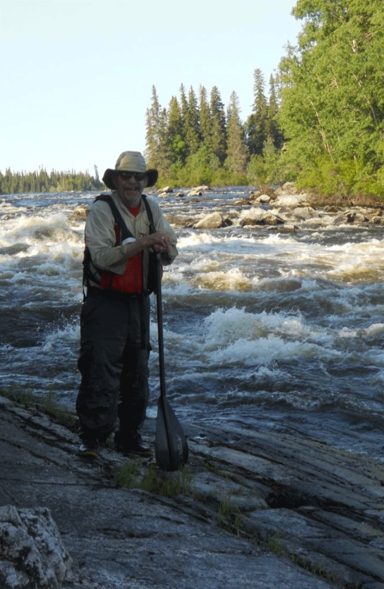
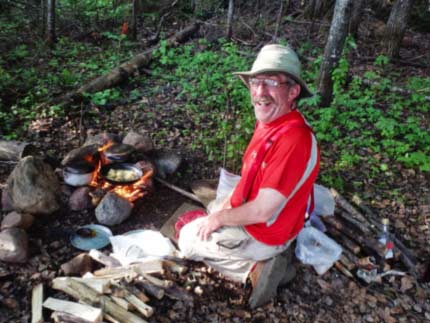
Jerry, Pipestone Pete, at Big Rapids.
-
-
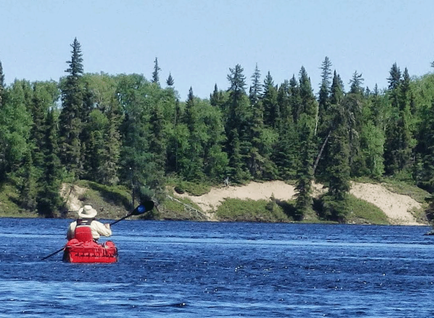
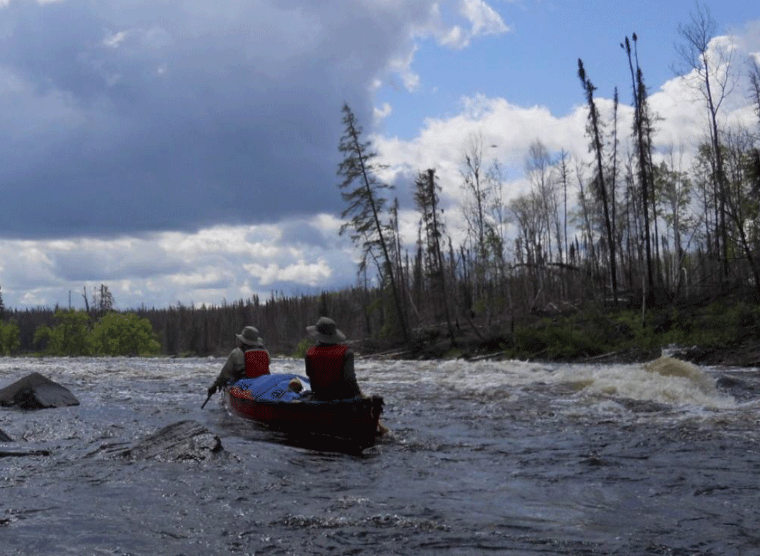
Jerry paddling by an esker on the Upper Winisk.
-
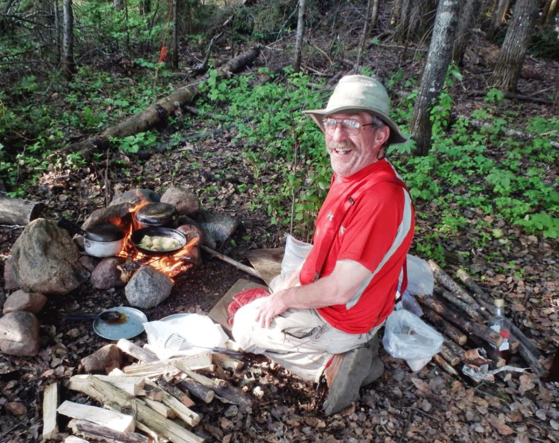
Kevin in camp.
-
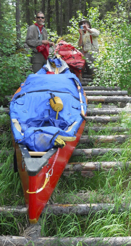
Kevin and Jerry pulling canoes over log portage.
-
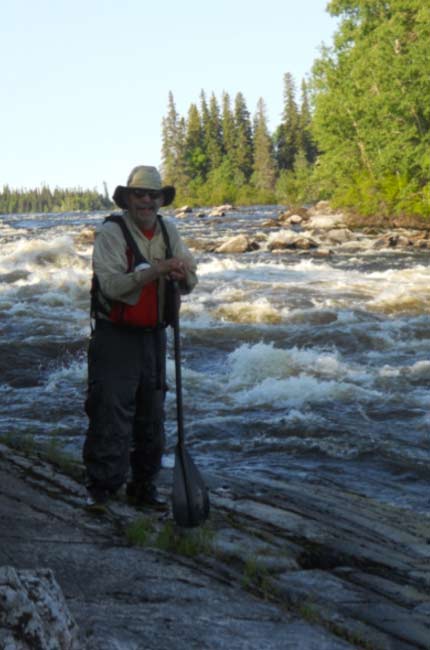
Kevin and Jerry running the Pipestone River
TRIP LOG: Submitted by Vern Fish June 2014
| Trip Dates: | June 17 – July 1, 2013 | |
| Nearest City: | Pickle Lake, Ontario | |
| Nearest Villages | Big Beaver House | |
| Wunnummin Lake | ||
| Summer Beaver | ||
| Webequie | ||
| Put in Point: | Northwest of Pickle Lake, Ontario- 2.5 hour drive | |
| Take out Point: | Just west of Webequie, Ontario (Kanuchuan Lake) – 2+ hour flight | |
| Water level: | High | |
| Canoes | Spirit II, Wenonah (17 ft, Royalex, with a Paddedry Canoe Cover) | |
| Wilderness Solo (15.6 ft, Royalex, homemade spray skirt) | ||
| Paddlers: | Kevin Groeneveld, Chanhassen, MN | |
| Jerry Storm, Cook, MN | ||
| Vern Fish, Waterloo, Iowa | ||
| Difficulty: | Moderate to Advanced – This trip requires remote wilderness camping skills and the ability to read and paddle whitewater from CI up to CIII+. | |
| Maps: | 53B16 Wachusk Lake | |
| 53A Wunnummin Lake | ||
| 53A13 Big Beaver House | ||
| 53B09 Opapimiskan Lake | ||
| 53B08 Forester Lake | ||
| 53B07 Mawley Lake | ||
| 53A16 Wapikopa Lake | ||
| 53A15 Sennett Lake | ||
| 43D14 Winisk Lake | ||
| 43D13 Kanuchuan Lake | ||
| Distance Traveled: Rapids Run Rapids Linned Portages Dumps Submitted by: |
200 Miles 44 8 11 3 Vern Fish, vernfish@aol.com |
|
Description:
Our route follows the Pipestone River Provincial Park from a road access north of Pickle Lake to Kanuchuan Lake. The Pipestone River flows into Wunnummin Lake where it merges into the headwaters of the Winisk River. From Wunnummin Lake the Winisk River flows northeast into Winisk River Provincial Park and village of Webequie. The Winisk River continues on to Hudson Bay. This route cuts through the granite of the Canadian Shield and features a variety of whitewater, waterfalls, small and big lakes.
We found online trip reports (Worth Donaldson –www.myccr.com) and very detailed maps for the first half of the trip from road down to the village of Wunnummin on Wunnummin Lake at http://kokanie.ca/pipestone-river-canoe-route. The Canoe Atlas of the Little North provided most of the information for the last half of the trip on the upper Winisk River. The Atlas also provided many small details about portages, falls and the local people. The first half of the trip was a series of white water rapids and waterfalls that was broken up by the occasional small lake. The last half of the trip was a series of big lakes broken up by the occasional rapids or falls.
We were able to find campsites and most of the portages on the first half of the trip. Many of these portages had been “sterilized” by very hot forest fires. Some of these areas had been completed stripped of trees and it very much like hiking in a sandy desert. We had a great of trouble finding campsites and portages on the last half of the trip. We pitched our tents along abandoned portages or just found a flat rock along the shore line.
Day 1 – June 17
We stayed at Lynn Cox’s Bed & Breakfast in Pickle Lake the night before. Lynn helped us find Jim Bradley of Cristal Lake Camp to drive us up the gravel road to the put-in point. Jim loaded all of our gear and our two canoes into the back of his pick-up. The three of us load into the crew cab with Jim and his 100 pound Labrador, Baxter. Baxter is my buddy for the next two hours. Jim had worked in the Northwest Territories and he shared several stories of his life up north and in Pickle Lake.
On the way up we cross the Ozhiski which feeds into the Attatwapiskat. This could be a river worth exploring for a future trip. We also cross the access to the winter road that leads to Wunnummin Lake. After a couple of hours of driving on a pretty good gravel road we end up at a remote bridge crossing. This road provides access for a gold mine so it is well maintained. Jim helps us unload and wishes us the best of luck. After months of planning and days of driving we are finally ready to push off.
A look downstream revealed a Class II slot under the bridge almost immediately after we leave the landing. The map shows four more CIs or CIIs within the first kilometer. We will not get a couple miles of paddling to warm up before we hit the whitewater!
In hindsight, we should have portaged over the road and put-in downstream of the bridge. But adrenaline and lack of sleep overcame common sense. We came up north to run whitewater and this would be our first test! This would be our first mistake of the trip.
The first canoe ran right through but the second canoe rolled. It took a fair amount of time to pull this canoe out of the strong back wash and get bail it out. The only thing we lost was a day pack. However, this day pack had our truck keys, a passport and our money. Unless we found this pack, we were going to have a tough time going home!
The fun had just begun. We rolled another canoe on the next rapids. By now we were pretty good at canoe rescue and we did not lose anymore gear and no one was hurt. But the chances of finding that day pack were growing dimmer as the sun began to sink in the west. That pack had been in fast moving water for over two hours. We had a choice of going through a set of three islands across the river on the left, center or the right. We went right and as we pull into the eddy we spotted a little pack going around and around in a slow dance with the river. This would be our first “river miracle”
Lost in all of excitement was a great series of CIs and CIIs that we did run successfully. All in all it was a pretty good first day!
Day 2 – June 18
We broke camp by 8 am and immediately found two really nice campsites just downstream. This would happen several times on this trip. The next bend includes a couple of CIVs with a ledge in between. We clear a few logs off the portage on the right and polish our rusty portage skills. The river now splits around a big island with no name at the 15 km mark. We take the south channel.
Kevin and I pull up on an island to check out the rapids on the right. Jerry portages over the island and we have nice run down the left side. We paddle by a little bay on the north that offered several sandy beaches on which to camp. The next run of white water was a powerful set of CIII-IV. The portage on the left was completely blocked off by down trees, so we lined our way to the bottom of the run.
The next portage on the left was also lost in a tangle of down trees. It was late and so we throw up our tents in the trees along the portage trail on river left above a long run of CIIIs. Tomorrow we must figure out a way to go around or down this cascading ladder of water.
Day 3 – June 19
It started to rain just before day break and the water pooled up under my tent. Not a great way to start a tough day. Everyone is moving a little slow. We took another look at the long set of rapids and decided to load up.
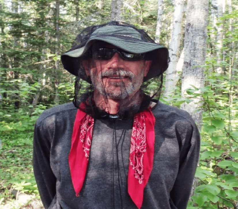
We ran, lined and portaged a long series of CII/III carried over a ledge and then the two boats leap frogged from eddy to eddy until we came to the last CIII/IV. We helped Jerry carry his solo over a burned over portage on the right while Kevin and I paddled. Jerry filmed our run from above. To set up the camera, Jerry had to look into lens a couple times. By now he is looking pretty rough. The face in lens could be the long lost “Pipestone Pete”.
As we cleared the east end of the big island, we could see that the north channel was filled with rocks. I could see why the “preferred” route avoided this rock garden! Just downstream we saw one of the few moose we would see on this trip.
As we came up on the 30 km mark, we were met with a hard left bend that disappeared around a tall esker. The water was raging white all the way around the bend. We climbed the steep sandy hill and stopped to take lunch. We hiked out to the end of the point and tried to find a line through this maze of whitewater. We had a great birds-eye view from up on the top, but we just could not see a clean, safe line. We carried up and over the hill and back down to the river.
The run down to Markop Lake was calm and relaxing. We were happy to get out and explore the falls just upstream from the portage into Markop Lake. The 1997 fire that burned across this portage had left nothing! We found an aluminum, flat bottomed boat that had melted! We camped on white sand with a few black logs for contrast. I could see nothing but white sand going over a distance hill. It was very strange able to look right through a boreal forest. It reminded me of pack backing in Utah.
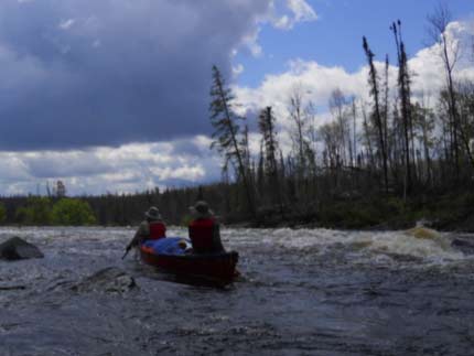
Jerry, “Pipestone Pete”, at Big Rapids.
Day 4 – June 20
We all portaged around the falls and Jerry portaged around the following rapids while Kevin and I ran them. At the bottom of the rapids Jerry said we slide up against an unknown rock on a ledge and over we went. I banged my left hip on the ledge and it really hurt in the cold water!
But now we got our second “river miracle”. Almost immediately we landed on huge, flat underwater rock where we could stand and bail out the canoe. We went a little ways downstream where we pulled up and changed into dry clothing.
Our map notes said we line the left side of the next falls but we quickly ruled out that option. The portage was a tough carry through blow down. The next rapid was a long hike across a sandy waste land on the right. You could see a rock cairns every now and then but the trail and trees were completely burned away. I have never been able to see that far across the portage before.
Because the next portage was across a series of white sand dunes with no trees, I could see the entire series of the rapids below me. It was an absolutely, incredible run of CIII-IV whitewater! I am sure that there are paddlers that could run that series but I was very glad to portage.
Finally, we came to Hole-in-the-Wall Falls at 45 km. It was a short carry on a bright, sunny day. We had plenty of time to find the hole on river right side of the falls. This would have been a great place to camp but it was the wrong time of day and we were already behind schedule. We paddled through a couple CIs on our way to Karl Lake. We should have seen a winter road crossing the river but I missed it. We stopped at the MNR “tin” cabin so I could stretch my bruised hip. According to my map, there should be a gold mine less than 20 km to the west.
Finally, we crept down the right side looking for the exit above the next falls. Our map notes said this was a gorgeous campsite overlooking the falls. It was.
Day 5 – June, 21
We pulled the canoes through the campsite, around the falls and back into the water. This was a long, mostly flat paddle down to Wastayanipi Lake. According to the Canoe Atlas, Wastayanipi means “end of clear water”. Along the way we passed the 60 km mark. We have gone 36 miles in 4.5 days on 200 mile trip! At this rate we will be camping in the snow. I knew that the first half of this trip was going to take longer because of all of the whitewater but now I am little worried about just how far we will get.
On Wastayanipi we find Pete Johnson’s first outpost cabin. Nice little cabin. Many paddlers have explored this cabin and most have carved their name into the posts and walls. “lost my canoe at Markop Lake”. “waited two days for my plane”. We hunted for the gravesite that was supposed to be across the bay. Found signs of people but no real evidence of a grave.
We paddled down the lake and found a very long wave train at the exit. I am pretty sure we could have run these waves but we lined around the first one and then ran the last CI. We spent the night on an island that our map notes indicated was a good site but with lots of garbage. The map was right. There were fishing nets, sleeping bags and other camping junk scattered across the island. After supper a swan flew over the island. We did 15 miles today and have now gone over 75 km.
Day 6 – June 22
Off the island we hit a series of three rapids which we ran and lined as needed. From there it was a long paddle into Assin Lake and Pete Johnson’s second cabin. The first cabin was rustic; this one was a step above a Holiday Inn. From the deck we watch cow moose and her calf plow through the wetland out in the bay. The sign-in book did not indicate a lot of people had been there but they all had caught walleye! We are now almost 95 km into the trip.
We could see where the winter road to Big Beaver House Village came down to the water from the south, across the lake and climbed up the shore on the north. Jerry caught five walleye as we trolled across the Assin Lake to the best campsite of the trip! The sandy beach provides a perfectly flat, soft site. We had a fish dinner under the tarp, watched sunset and lite a fire on the beach. Paddling does not get much better.
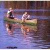
Cooking on Assin Lake.
Day 7 – June 23
We left our “Hilton on the Assin” and headed for the exit. The series of rapids out of the lake turned hard to the right to give it the shape of a C. It turned out to be a very nice CI-II series. We ran another very series of CI’s down to the “dead lake”. At this point water can either flow north toward Big Beaver House or continue on down the Pipestone to Hilyard Lake.
The exit out of the dead lake required us to run Manitou Falls which was also known as God’s Rapids or The Gate. Supposedly, when the steep waves subside, you can run the “open gate”. There was also supposed to be a white cross at the bottom of the run. With all of that hype, we approached this water falls with caution and ate lunch while we scouted.
We could not find a cross and the portage was not passable. The falls was a powerful but a straight CII. We ran the “gate” and later meet our first motor boat. The crew waved and took our picture. We are guessing that this rapids was blasted clear to allow boats to move from village to village.
We skipped a pretty good campsite and were forced to camp on a portage above the next rapids. As we were setting up a motor boat went down the rapids. After our night on the beach, this was like being transferred to the Bates Motel. We traveled 20 miles and are about 80 miles into the trip.
Day 8 – June 24
We pulled out of the “make do” campsite and found a line down the rapids. At about mile 84 we ran the rapids on the north side of an island without even looking for a portage. We did the same thing as we dropped into Hilyard Lake. There was supposed to be a cabin on the south side of the lake but I did not see it.
Clouds and wind begin to chase us across Hilyard as we squeeze between the island and esker ridge. We now the hug the north shore because other trip reports have indicated that you cannot run the rapids on the south side of the next island. These reports indicate you should take the half mile winter road across the island. We see the road opening but decide to run the easy white water on the north side and stop at the first eddy. We can now hear a roar from the next rapids so Kevin rock hops down the shoreline to see how bad it is.
This is far more white water then we want to run. While we were exploring the rapids, Jerry finds a log portage and we begin the process of pushing and pulling the loaded canoes across. It hindsight might have been easier to just unload and portage. Kevin found a good sized garter snake under the log portage. I am guessing this is on the far northern edge for this snake’s range.
Now the fog has moved in and it is raining. The temperature is falling and we are fighting a quarterly wind. We can’t see the Wunnummin Peninsula and we can’t find a beach or a flat rock to land on more or less pitch a tent. To make matter worst, I have to keep bailing the boat. About every 10 minutes I can feel my bail bucket floating around by ankles. We may have a hole in the boat!
We tack our way into the wind between Bury and Porter Islands. We are now close enough that we can see the road on the peninsula. We even see a truck going south towards the airport. We land on sandy beach, wet and cold.
We wave at the first truck and say hello to Ralph and Paulina Winter. We ask if it is alright to camp on the beach. Ralph asks if we want to spend the night in his tipi in town. At this point a night in a dry tipi sounds pretty good. We unload the canoes and load into his truck. Now I can see the hole in my canoe. Ralph says bring it along, he can fix a little hole like that.
This is my third “river miracle.” First, that I did not do a lot of damage to the canoe and second I had an expert on hand to patch the boat! We must have dragged the boat over loose nail on the log portage. Jerry has three “almost” nail holes in his solo. We have used log portages on other trips without any problem. But all it takes is one rough edge or loose nail to put a hole in the boat. Lesson learned!
Ralph and his wife bring food and spend most of the night telling us about their life in the north and their community. We heard stories about hunting moose, caribou, geese, fishing and running whitewater. Ralph said that he can run the same river in five days! Obviously, we were portaging far more often than Ralph would have.
We had seen the winter road into Wunnummin Lake several times on our way into the village. Ralph told us how a visiting hockey team had driven a greyhound bus up from Pickle Lake and over the winter road. He said it was hard for the villagers to believe. I could not image driving a big bus down that temporary road!
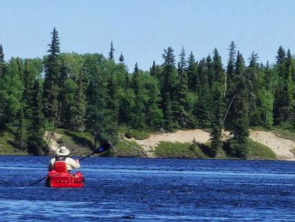
Paddling by an esker on the Upper Winisk.
Day 9 – June 25
Ralph feeds us breakfast and gives a tour of the village. We take a trip down to airport and power plant. They burn fuel oil to generate power. All of this fuel must come in over the winter road. If they have a short winter and road breaks up, they do not get enough fuel for the next season.
It is time to leave but I have mixed emotions. First, this would be a good point to end the trip. We have run the river and we have come back into civilization. It is hard load the canoe and get back into a wilderness mindset. Second, now we must cross a Wunnummin Lake, which is a BIG body of water. To quote the Canoe Atlas of the Little North,
“The route opens into the wide waters of the lake. This is a challenging paddle under clear or stormy skies”
Ralph warns us that this could take most of the day just to cross the big lake. I can see why most groups end the trip and fly out at this point. Ralph helps us locate a couple of campsites and a few good fishing spots on the map. He wishes us the best of luck and tells us to look him up on his Facebook page!
A second quote from the Canoe Atlas of the Little North,
“A beautiful run down wide, fast and open water from Wunnummin Lake, through Sennet Lake, Nibinamik Lake, and north east to Wapikopa Lake….There may be as few as two portages along the entire descent….it is an enjoyable ride!”
How can you read those lines and not push on across the lake? Our luck continues to hold and the trip across the big lake went well. We had some light wind and a little chop but no water over the bow. We had more trouble finding the exit off the lake and back into the river system. There were several confusing bays and openings to test our map reading skills.
Ralph had directed us to cabins owned by his family at the entrance to the Winisk River. We found the site. There were several old cabins, picnic tables and a standing tipi frame with a fire place. Jerry cooked up the three walleye he caught and we had a pretty good “first” night back in the wilderness. With a late start we cover 11 miles for a total over 100 miles.
Day 10 – June 26
A morning fog delays our departure so we explore the fish camp. There are a lot of cabins scattered across a pretty wide area. Most are not in very good shape. We paddle up the big bay and into the Upper Winisk River. At the point where we turn north, we could see Cemetery Point. You can see several white crosses on the hill. I did not want to get out and explore. This is a private place that I had not been invited to visit.
We run a wonderful set of CI-IIs down to Sennett Lake and finally stop at one of Ralphs fishing spots and a campsite. Jerry brings home five walleye for supper. That night we watch the same motor boat filled with young adults go both up and down stream. I am assuming they are coming from Summer Beaver the next village on the route. We are running out of time to get to Webequie. We may have to end the trip at Summer Beaver and call for the plane. We are now about 115 miles into a 200 mile trip.
Day 11 – June 27
We leave our nice little campsite and immediately run into white water. I am in the bow today so I am getting wet. In addition the wind is now coming out of the northeast so it feels like we are paddling upstream. After lunch in the woods we find another “hunting” shack. If we had paddled another 40 minutes we would have had a great place to take lunch! A sleeping bag is hanging on the back wall but there is very little else on the site.
We are crossing big lakes and fighting the wind. We finally give up and carve a campsite out of the moss on an island downstream from Penn Island. We can smell smoke from a distant fire. We are about 130 miles into the trip.
Day 12 – June 28
Early in the morning we came to a sandy beach which would have been a much better campsite then the “boreal nook” we carved out of the forest. This beach also came with cabins, benches, a dock and fishing cleaning stations. As best we could figure, this was some kind of summer camp. We spent far too much time stretching our legs and trying to not think about our next big choice. Summer Beaver was within an hour paddle and we had been told it had a ‘great little store”. If we wanted to quit and call in the plane, this would be our last chance.
We came to the fork in the river at Giblin Island in Nibinamik Lake. We could see the radio tower in the distance and we stopped for few minutes to discuss our options. We decided to keep paddling down the Winisk. At this point I think we all just want to finish what we had started.
Summer Beaver came and went but the white water just kept coming. The Winisk now splits around a big island and we plowed into the couple of CII-IIIs with big standing waves on the south fork. Kevin was in the front and I watched him go almost vertical in boat as the water crashed in around him. I had my camera pointing backwards so the only image I have is the back of the canoe lifting over the horizon and dropping back down. I do have Kevin’s voice on tape. He was very animated!
We stopped and camped on the portage before the next big run. This turn out to be a very nice location with lots of room. The mosquitoes were out in force, so we retreated to our tents. We are at mile 151.
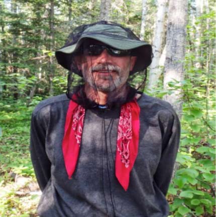
Kevin in camp.
Day 13 – June 29
Now that we have committed to going all the way to Webequie we need to cover some distance in the next few days on these big lakes. We lined the upper part of this two part rapids and then ran the lower half. I had my camera running in the boat and Jerry filmed us coming down stream. That was the excitement for the day.
We are now on Lake Wapikopa which is a lot of open water. The water level was high and again we were forced to carve out a spot in the woods to take lunch. We can’t find any exposed rocks! We search and search and finally find a burn over spot on the south shore just before Turtle Island. We find room for the tents and make the best of the available accommodations.
The air is just dead silent. There are no planes, no boats, no campsites, not even an occasional piece of shore junk. There are NO signs of people. It feels like we are traveling in the Land Forgotten. This stretch of the river is not on the beaten path. We are about 166 miles into the trip.
Day 14 – June 30
We broke camp at 7 am and paddled into a stiff wind. The wind worked up waves that enhanced the white water breaking over the rocks as we went by Turtle Island. We ran some more small rapids to get into Chipai Lake. We weaved our way past Howson Island and south of Ivey Island. The map showed what looked like a shortcut to Ferron Island just east of Cotter Island and south of Blackler Bay.
We paddle into lovely little stream that was a break from the big water we had been paddling. Kevin figured that this saved about 1.5 miles on our transition to Kanuchuan Lake. At this point these big lakes kind of merge together, it is hard to see where one lake starts and another one ends.
We were coming up on Long Rapids and running out of day light but we could not find an open rock or a sand beach. We finally found a narrow slice of sand with just enough room to pitch our tents. A power boat went by and waved before it went into Long Rapids. Today is June 30 and we are at about mile 185. We had told our pilot that we would be in Webequie on July 1 or 2. We need to cover at least 15 miles tomorrow to get close the village.
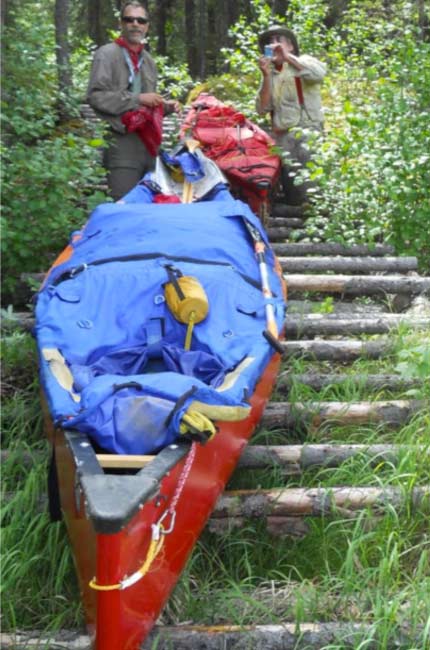
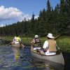
Kevin and Jerry pulling canoes over log portage.
Day 15 – July 1 “The Last Day”
We are up and on the water before 7 am. We are ready to go home. Long Rapids must have been flooded out because it was just a long set of rough water. By now we are tired, over confident and willing to take risks to get done.
The name Big Rapids or “Kitche Powitik” should have been a clue that this was going to be CIII or bigger. The map showed a portage that indicates that this rapid is not runnable. The change in elevation above to below was over 10 feet. That should have been the final clue.
We got lazy, sloppy and lined up on river left. The portage was on the right. We did not even bother to stop and scout the first drop. It looked very doable. We rolled into the first line of water with no problem. As we turn right towards the second drop, all I could see from the bow was one huge “haystack” of waves. I yelled at Kevin, “you do not want to go there!”
We hauled *** towards the island in the middle of this mess. The current turned the stern downstream and now we are heading backwards into the drop. We got to the island and found a way to stay put until we could line our way down the side of the “big rapids”. Jerry took the clue and headed over to the top of the portage. We finally got to the bottom of the portage and helped Jerry line his boat down the right side of the falls.
“Holy *** that was too close!”
We all shook hands took pictures and said our thanks before getting back into the boats. Black Rapids was pretty well drowned out but there was an old “stockade” style cabin with vertical logs. The walls were covered with cardboard and snowshoes with a variety shotgun shells scattered on the table and the floor. The clock hanging over the door is now permanently set at 5:28. We spent too much time just looking around.
Rapids of Many Islands was filled with little islands and easy CIs. We then paddle south to find the opening that allows us to paddle north. We are just a couple of twists and turns from Ice Chisel Falls which is the last rapid before we paddle into Winisk Lake and Webequie.
A yellow float plane now makes a pass over us. He does a wing wag and makes another pass. Then he puts down right in front of us. The next thing I see is prop spinning off the bow of the canoe. The pilot gets out and yells, “you Vern Fish?” I yell back, “you Pete Johnson?”
I had struggled to find a pilot and plane that would haul our canoes and yet be flexible on when and where they would pick us up. Not every pilot is willing to lash two canoes on their floats and haul three guys and their gear on short notice. After numerous emails I finally got a call from Pete Johnson. Pete told me to put his email into my SPOT unit and he would track our progress down the river. This would allow us to send him a message from our SPOT telling him to pick us up where ever we decided to quit.
The problem was I entered the wrong email address for Pete. When he landed he wanted to know if we had lost our SPOT. He had not known where we were since we started. He had gotten word from the guy in boat that two red canoes were entering Long Rapids. Using this information he flew to Webequie and started working his way upstream until he found us. This is the last “river miracle” for the trip. I still find it amazing how fast information can travel in the north. Thank you Pete Johnson!
Jerry and I were happy to be flying home but we were both a little disappointed that we had not be able to push on to Webequie. In 2011 we had paddled the Winisk River from Webequie to within 20 miles of Hudson Bay. If we had finished this trip at Webequie, we would have paddled all of the Winisk River except the last twenty miles. Either way, there are not too many people who can say that they have paddled all but 30 miles of the Winisk River!
Pete flew us back to Pickle Lake where we used his shower to clean up. We stopped in Sioux Lookout to eat a late lunch and then pushed on to Fort Francis. Since it was July 1 and Canada Day, they were shooting off fireworks. Rainy Lake was sparking from the aerial display as we crossed the border. It was a hell of a way to end a great trip!
Kevin and Jerry running the Pipestone River.


Thank you for sharing your trip. When I was 11 yrs. Old, a group from Three Rivers, MI went on a Winisk River trip. Your trip sounds a lot like our trip. We finished at the Winisk eskimo village. Took motor boats out on Hudson bay.
Three friends and I took a Winisk trip in 1983. We had one bad spill and paddled a section that went through an active forest fire — great fun! Back in those days, there was no communication from the time we left Pickle Lake until we got back to Pickle Lake, 12 days later. Our wives were pretty nervous.