Celebrate Wilderness Solitude in Quetico Provincial Park
It has been one hundred years since Quetico Provincial Park was recognized as a unique canoe country worthy of protection. Located just across the Minnesota-Ontario border from the Boundary Waters Canoe Area Wilderness – the two canoeing areas make up the largest international wilderness recreation area in the world – Quetico remains a remote and beautiful wilderness where paddlers can still find the magic of the north. Yet with all the hype surrounding the BWCAW, Quetico must sometimes feel like the “other brother;” a little more rugged and a lot less demanding of the spotlight, its charms don’t get nearly the acclaim they deserve. In an increasingly busy and noisy world, Quetico offers a sense of the days of old, before recreation development, when native people and fur traders traveled the region by canoe.
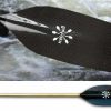
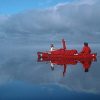
Quetico Park, Photo by Kevin Callan
Photo by Kevin Callan
Quetico Park, Photo by Kevin Callan
Photo by Kevin Callan
Hunter Island, Quetico Park, Photo by Kevin Callan
Photo by Kevin Callan
Solitude by Design
Quetico Provincial Park has carefully preserved the solitude of the wilderness experience. A conservative permitting system limits visitors to about 20,000 per year. Portage landings are unmarked, campsites are not designated, and in an effort to encourage low-impact camping, there are no latrines or fire grates. The portage trails connecting lakes are less used and less maintained than those in the BWCAW, and it is not uncommon for campers to find themselves facing deep wells of muskeg and rigorous climbs all whilst carrying a canoe on their shoulders.
The tradeoff for all the hard work is a wilderness immersion that is sometimes easy to lose track of in Quetico’s busy cousin, where 200,000 visitors create concerns over loving a wilderness to death. In the BWCAW, campers bottleneck at portages, groups camp early to snag campsites, and the preservation of wilderness character depends on the willingness of neighbors to respect the peace and quiet. In Quetico, it’s still easy to have an entire lake to oneself, sitting at the edge of a campsite after dinner and listening to loons call during the twilight hour. It is from that solitude that the true wilderness experience emerges, and the observant paddler will find that there is much to see in Quetico.
All in the Details
Quetico is known for a rugged beauty best appreciated by a trip into its interior, where its splendor is revealed not in sweeping vistas but up close and in person. The simple lyrics of the traditional Canadian folk song, Land of the Silver Birch, celebrate the “blue lake and rocky shore” that typify this northern canoe country:
Land of the silver birch,
Home of the beaver
Where still the mighty moose
Wanders at will
Blue lake and rocky shore,
I will return once more
Quetico Park owes this unique character to its geologic history and its location just west of Lake Superior. About forty miles long and sixty miles wide, it lies at the junction of several ecological zones – mixed forest to the south, boreal forest to the north, and plains to the west. As a result, Quetico contains a wealth of flora and fauna: wild flowers and berries line portages and fill sunny clearings; sightings of moose, black bear, or beaver are common rewards for quiet campers; and it is still possible to hear wolves howling in the night. Campers pitch their tents under coniferous forests of white pine, jack pine, and black spruce as well as deciduous birch and aspen that blanket the Canadian shield – Precambrian bedrock exposed by glaciers 13,000 years ago. Smooth rock shelves sloping to the water at camp sites, parallel lines called striae etched across bare bedrock, and the parallel north-south orientation of long, skinny lakes like Agnes and the Man Chain along old fault lines all speak of the glaciers that once buried the region.
Place of Legends
In the quiet wilderness of Quetico Provincial Park it can be hard to imagine a time when logging or the sounds of Voyageur songs keeping time with their paddles permeated the solitude. But traces remain of the region’s vibrant human history.
Once inhabited by the Anishinabe, Quetico is home to 28 known pictographs. According to the Quetico Foundation, these small depictions of people, animals, canoes and hands were most likely painted within the last 500 years using red ochre. Most often found on cliff faces overhanging the water, they still hold spiritual and cultural significance for the Anishinabe, who believe they represent the spirits inhabiting the rocks. Out of respect for these beliefs, the Park allows visitors to make small offerings to these spirits by sprinkling sage, tobacco or cedar on the water below the rock. Visitors can also show their respect by refraining from touching (oils in human skin accelerate fading) or photographing the images.
Other reminders of the past can be found in lake and portage names that keep the legends of the fur trade alive. Rival trading companies, the Hudson’s Bay Company and the Northwest Company, trapped and traded throughout the region, and in Quetico and Beyond, Kevin Callan reminds us that the Portage des Morts, an alternative to the Grand Portage once used by the Northwest Company to disrupt the Hudson’s Bay Company trade routes, is so named because a voyageur was crushed by the weight of his own canoe and buried nearby. But modern day legends live on as well.
Rumors swirl among canoe camps that frequent Quetico, suggesting strange encounters in the dark nights of the Sturgeon narrows, including the eerie sounds of voyageurs singing in the woods and camp gear rearranged during the night. Campers tell tales that grow taller with every telling, reliving grueling portages into Pooh Bah Lake or slogging through muskeg up to the neck. But some of their experiences are simple sightings of relics from the past, when the park was logged and other natural resources were extracted for human use. Callan’s book sites several locations where the remains of old wooden barges and boilers can be found, and left over debris from a 1936 log jam can still be seen at Chatterton Falls.
In this way, Quetico Provincial Park remains a place where yesterday’s history combines with the beginnings of tomorrow’s legends. And in the quiet solitude of Quetico Provincial Park, it is easy to envision a wilderness that will remain forever unspoiled, a land of pristine lake and moose grazing near rocky shore.
Don’t Miss These Quetico Features
Pictographs:
There are 28 known pictograph sites throughout Quetico Provincial Park – part of the largest known concentration of rock paintings in North America. Noteworthy sites include:
A tall granite rock face at the South end of Darky Lake features several groupings of pictographs, including images of men in canoes, moose, and hunters.
Four separate groupings line the north shore of Quetico Lake.
Agnes Lake is home to six pictograph sites and the only known petroglyphs (rock carvings) in Quetico.
Geologic/Historical Sights:
Striae – parallel lines and marks left on exposed bedrock by glaciers – can be seen on Sturgeon Lake (just west of the narrows), Knife Lake, Otter Track Lake, Saganagons Lake and the west shore of Cairn Lake.
Warrior Hill – Some legends posit that Native American warriors used this expanse of bare rock to test their mettle by sprinting to the top of the hill. Visible from some distance away, Warrior Hill is located on the eastern shore of Lac la Croix.
Wild Berries
Every wild bear knows there is nothing like fresh blueberries or raspberries sprinkled over your morning meal. Campers can enjoy them, too. Look for wild berries on your next trip and taste for yourself how much better they are than store-bought berries (remember, animals know where to look for them, too, so forage with friends and keep an eye out for wildlife):
Strawberries come into season from mid-June to mid-July. Look in sunny patches alongside portage trails.
Raspberries from mid-July to mid-August. They can be found in sunny clearings near portage landings and disturbed areas.
Blueberries are the jewel of the north. Look for them between mid-July and mid-August on the east and south east of rocky hills, near bogs and in sunny patches.
Article Resources and Suggested Reading:
Quetico and Beyond, by Kevin Callan
Quetico Provincial Park: An Illustrated History by Shirley Peruniak
Reading Rock Art: Interpreting the Indian Rock Paintings of the Canadian Shield by Grace Rajnovich
by Alissa Johnson
Related Links:
———————————————————
Canoeing.com Destination Guide
Canoeing.com Recommended Quetico Routes
Waterfalls of Quetico
2009 Centennial Events Calendar
Canoe the Heart Centennial Canoe Voyage
MORE TO EXPLORE:
———————————————————
Quetico Superior Centennial / History >